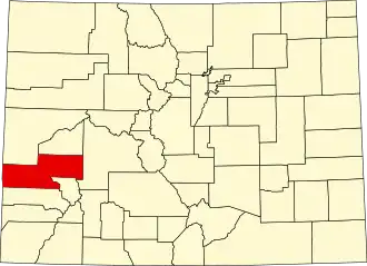
Montrose County
| County in de Verenigde Staten | |||
|---|---|---|---|
| |||
| Situering | |||
| Staat | Colorado | ||
| Coördinaten | 38°24'36"NB, 108°16'12"WL | ||
| Algemeen | |||
| Oppervlakte | 5.808 km² | ||
| - land | 5.803 km² | ||
| - water | 5 km² | ||
| Inwoners (2000) |
33.432 (6 inw./km²) | ||
| Overig | |||
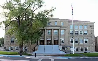
| Zetel | Montrose | ||
| FIPS-code | 08085 | ||
| Opgericht | 1883 | ||
| Website | www | ||
| Foto's | |||
| |||
 Bevolkingspiramide Montrose County | |||
| Statistieken volkstelling Montrose County | |||
| |||
Montrose County is een county in de Amerikaanse staat Colorado.
De county heeft een landoppervlakte van 5.803 km² en telt 33.432 inwoners (volkstelling 2000). De hoofdplaats is Montrose.
Bevolkingsontwikkeling
| Jaar | Inwoners | % ± | |
|---|---|---|---|
| 1900 | 4.535 | — | |
| 1910 | 10.291 | 126,9% | |
| 1920 | 11.852 | 15,2% | |
| 1930 | 11.742 | −0,9% | |
| 1940 | 15.418 | 31,3% | |
| 1950 | 15.220 | −1,3% | |
| 1960 | 18.286 | 20,1% | |
| 1970 | 18.366 | 0,4% | |
| 1980 | 24.352 | 32,6% | |
| 1990 | 24.423 | 0,3% | |
| 2000 | 33.432 | 36,9% | |
| Bron: (en) Historical Decennial Census Population | |||
.jpg)