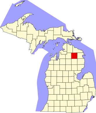
Montmorency County
| County in de Verenigde Staten | |||
|---|---|---|---|
| |||
| Situering | |||
| Staat | Michigan | ||
| Coördinaten | 45°1'48"NB, 84°7'48"WL | ||
| Algemeen | |||
| Oppervlakte | 1.456 km² | ||
| - land | 1.418 km² | ||
| - water | 38 km² | ||
| Inwoners (2000) |
10.315 (7 inw./km²) | ||
| Overig | |||
| Zetel | Atlanta | ||
| FIPS-code | 26119 | ||
| Opgericht | 1840 | ||
| Website | www | ||
| Foto's | |||

| |||
 Bevolkingspiramide Montmorency County | |||
| Statistieken volkstelling Montmorency County | |||
| |||
Montmorency County is een county in de Amerikaanse staat Michigan.
De county heeft een landoppervlakte van 1.418 km² en telt 10.315 inwoners (volkstelling 2000). De hoofdplaats is Atlanta.
Bevolkingsontwikkeling
| Jaar | Inwoners | % ± | |
|---|---|---|---|
| 1900 | 3.234 | — | |
| 1910 | 3.755 | 16,1% | |
| 1920 | 4.089 | 8,9% | |
| 1930 | 2.814 | −31,2% | |
| 1940 | 3.840 | 36,5% | |
| 1950 | 4.125 | 7,4% | |
| 1960 | 4.424 | 7,2% | |
| 1970 | 5.247 | 18,6% | |
| 1980 | 7.492 | 42,8% | |
| 1990 | 8.936 | 19,3% | |
| 2000 | 10.315 | 15,4% | |
| Bron: (en) Historical Decennial Census Population | |||