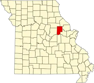
Montgomery County (Missouri)
| County in de Verenigde Staten | |||
|---|---|---|---|
| |||
| Situering | |||
| Staat | Missouri | ||
| Coördinaten | 38°56'24"NB, 91°28'12"WL | ||
| Algemeen | |||
| Oppervlakte | 1.399 km² | ||
| - land | 1.392 km² | ||
| - water | 7 km² | ||
| Inwoners (2000) |
12.136 (9 inw./km²) | ||
| Overig | |||
| Zetel | Montgomery City | ||
| FIPS-code | 29139 | ||
| Opgericht | 1818 | ||
| Website | mcmo | ||
| Foto's | |||

| |||
 Bevolkingspiramide Montgomery County | |||
| Statistieken volkstelling Montgomery County | |||
| |||
Montgomery County is een county in de Amerikaanse staat Missouri.
De county heeft een landoppervlakte van 1.392 km² en telt 12.136 inwoners (volkstelling 2000). De hoofdplaats is Montgomery City.
Bevolkingsontwikkeling
| Jaar | Inwoners | % ± | |
|---|---|---|---|
| 1900 | 16.571 | — | |
| 1910 | 15.604 | −5,8% | |
| 1920 | 15.233 | −2,4% | |
| 1930 | 13.011 | −14,6% | |
| 1940 | 12.442 | −4,4% | |
| 1950 | 11.555 | −7,1% | |
| 1960 | 11.097 | −4,0% | |
| 1970 | 11.000 | −0,9% | |
| 1980 | 11.537 | 4,9% | |
| 1990 | 11.355 | −1,6% | |
| 2000 | 12.136 | 6,9% | |
| Bron: (en) Historical Decennial Census Population | |||