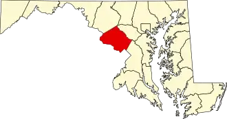
Montgomery County (Maryland)
| County in de Verenigde Staten | |||
|---|---|---|---|
| |||
| Situering | |||
| Staat | Maryland | ||
| Coördinaten | 39°8'11"NB, 77°12'15"WL | ||
| Algemeen | |||
| Oppervlakte | 1.313 km² | ||
| - land | 1.283 km² | ||
| - water | 30 km² | ||
| Inwoners (2000) |
873.341 (681 inw./km²) | ||
| Overig | |||
| Zetel | Rockville | ||
| FIPS-code | 24031 | ||
| Opgericht | 1776 | ||
| Website | www | ||
| Foto's | |||

| |||
 Bevolkingspiramide Montgomery County | |||
| Statistieken volkstelling Montgomery County | |||
| |||
Montgomery County is een county in de Amerikaanse staat Maryland.
De county heeft een landoppervlakte van 1.283 km² en telt 873.341 inwoners (volkstelling 2000). De hoofdplaats is Rockville.
Bevolkingsontwikkeling
| Jaar | Inwoners | % ± | |
|---|---|---|---|
| 1900 | 30.451 | — | |
| 1910 | 32.089 | 5,4% | |
| 1920 | 34.921 | 8,8% | |
| 1930 | 49.206 | 40,9% | |
| 1940 | 83.912 | 70,5% | |
| 1950 | 164.401 | 95,9% | |
| 1960 | 340.928 | 107,4% | |
| 1970 | 522.809 | 53,3% | |
| 1980 | 579.053 | 10,8% | |
| 1990 | 757.027 | 30,7% | |
| 2000 | 873.341 | 15,4% | |
| Bron: (en) Historical Decennial Census Population | |||
.jpg)