Montgomery County (Kansas)
| County in de Verenigde Staten | |||
|---|---|---|---|
| |||
| Situering | |||
| Staat | Kansas | ||
| Coördinaten | 37°12'NB, 95°42'WL | ||
| Algemeen | |||
| Oppervlakte | 1.687 km² | ||
| - land | 1.671 km² | ||
| - water | 16 km² | ||
| Inwoners (2000) |
36.252 (22 inw./km²) | ||
| Overig | |||
| Zetel | Independence | ||
| FIPS-code | 20125 | ||
| Opgericht | 1867 | ||
| Website | www | ||
| Detailkaart | |||

| |||
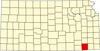
| Overzichtskaart van Montgomery County | |||
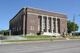
| Foto's | |||
| |||
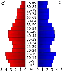 Bevolkingspiramide Montgomery County | |||
| Statistieken volkstelling Montgomery County | |||
| |||
Montgomery County is een county in de Amerikaanse staat Kansas.
De county heeft een landoppervlakte van 1.671 km² en telt 36.252 inwoners (volkstelling 2000). De hoofdplaats is Independence.
Bevolkingsontwikkeling
| Jaar | Inwoners | % ± | |
|---|---|---|---|
| 1900 | 29.039 | — | |
| 1910 | 49.474 | 70,4% | |
| 1920 | 49.645 | 0,3% | |
| 1930 | 51.411 | 3,6% | |
| 1940 | 49.729 | −3,3% | |
| 1950 | 46.487 | −6,5% | |
| 1960 | 45.007 | −3,2% | |
| 1970 | 39.949 | −11,2% | |
| 1980 | 42.281 | 5,8% | |
| 1990 | 38.816 | −8,2% | |
| 2000 | 36.252 | −6,6% | |
| Bron: (en) Historical Decennial Census Population | |||