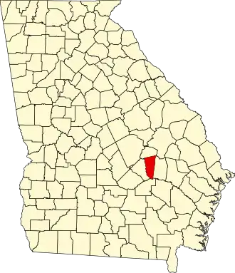
Montgomery County (Georgia)
| County in de Verenigde Staten | |||
|---|---|---|---|
| |||
| Situering | |||
| Staat | Georgia | ||
| Coördinaten | 32°10'12"NB, 82°31'48"WL | ||
| Algemeen | |||
| Oppervlakte | 640 km² | ||
| - land | 635 km² | ||
| - water | 5 km² | ||
| Inwoners (2000) |
8.270 (13 inw./km²) | ||
| Overig | |||
| Zetel | Mount Vernon | ||
| FIPS-code | 13209 | ||
| Opgericht | 1823 | ||
| Website | montgomerycountyga | ||
| Foto's | |||

| |||
 Bevolkingspiramide Montgomery County | |||
| Statistieken volkstelling Montgomery County | |||
| |||
Montgomery County is een county in de Amerikaanse staat Georgia.
De county heeft een landoppervlakte van 635 km² en telt 8.270 inwoners (volkstelling 2000). De hoofdplaats is Mount Vernon.
Bevolkingsontwikkeling
| Jaar | Inwoners | % ± | |
|---|---|---|---|
| 1900 | 16.359 | — | |
| 1910 | 19.638 | 20,0% | |
| 1920 | 9.167 | −53,3% | |
| 1930 | 10.020 | 9,3% | |
| 1940 | 9.668 | −3,5% | |
| 1950 | 7.901 | −18,3% | |
| 1960 | 6.284 | −20,5% | |
| 1970 | 6.099 | −2,9% | |
| 1980 | 7.011 | 15,0% | |
| 1990 | 7.163 | 2,2% | |
| 2000 | 8.270 | 15,5% | |
| Bron: (en) Historical Decennial Census Population | |||