Montgomery County (Arkansas)
| County in de Verenigde Staten | |||
|---|---|---|---|
| |||
| Situering | |||
| Staat | Arkansas | ||
| Coördinaten | 34°32'8"NB, 93°39'52"WL | ||
| Algemeen | |||
| Oppervlakte | 2.073 km² | ||
| - land | 2.023 km² | ||
| - water | 50 km² | ||
| Inwoners (2000) |
9.245 (5 inw./km²) | ||
| Overig | |||
| Zetel | Mount Ida | ||
| FIPS-code | 05097 | ||
| Opgericht | 1842 | ||
| Website | montgomerycounty | ||
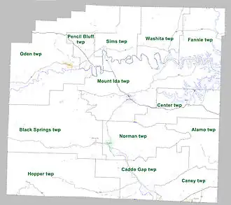
| Detailkaart | |||
| |||
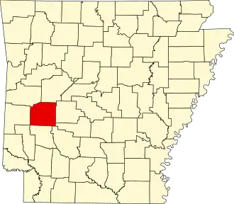
| Overzichtskaart van Montgomery County | |||
| Foto's | |||

| |||
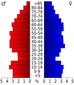 Bevolkingspiramide Montgomery County | |||
| Statistieken volkstelling Montgomery County | |||
| |||
Montgomery County is een county in de Amerikaanse staat Arkansas.
De county heeft een landoppervlakte van 2.023 km² en telt 9.245 inwoners (volkstelling 2000). De hoofdplaats is Mount Ida.
Bevolkingsontwikkeling
| Jaar | Inwoners | % ± | |
|---|---|---|---|
| 1900 | 9.444 | — | |
| 1910 | 12.455 | 31,9% | |
| 1920 | 11.112 | −10,8% | |
| 1930 | 10.768 | −3,1% | |
| 1940 | 8.876 | −17,6% | |
| 1950 | 6.680 | −24,7% | |
| 1960 | 5.370 | −19,6% | |
| 1970 | 5.821 | 8,4% | |
| 1980 | 7.771 | 33,5% | |
| 1990 | 7.841 | 0,9% | |
| 2000 | 9.245 | 17,9% | |
| Bron: (en) Historical Decennial Census Population | |||