Montayral
| Gemeente in Frankrijk | |||
|---|---|---|---|
 | |||
| Situering | |||
| Regio | Nouvelle-Aquitaine | ||
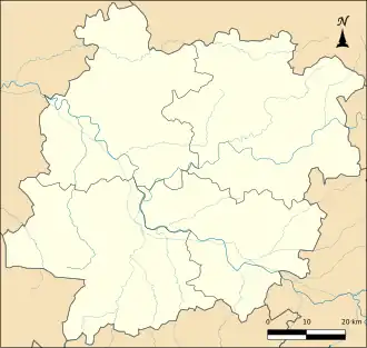
| Departement | Lot-et-Garonne (47) | ||
| Arrondissement | Villeneuve-sur-Lot | ||
| Kanton | Le Fumélois | ||
| Coördinaten | 44° 29′ NB, 0° 59′ OL | ||
| Algemeen | |||
| Oppervlakte | 24,54 km² | ||
| Inwoners (1 januari 2022) |
2.667[1] (109 inw./km²) | ||
| Hoogte | 57 - 227 m | ||
| Overig | |||
| Postcode | 47500 | ||
| INSEE-code | 47185 | ||
| Website | Officiële website | ||
| Detailkaart | |||
 | |||
| Foto's | |||

| |||
| Gemeentehuis | |||
| |||
Montayral is een gemeente in het Franse departement Lot-et-Garonne (regio Nouvelle-Aquitaine). De plaats maakt deel uit van het arrondissement Villeneuve-sur-Lot. Montayral telde op 1 januari 2022 2.667[1] inwoners.
Geografie
De oppervlakte van Montayral bedroeg op 1 januari 2022 24,54 vierkante kilometer; de bevolkingsdichtheid was toen 108,7 inwoners per km².
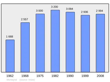
Demografie
Onderstaande figuur toont het verloop van het inwonertal (bron: INSEE-tellingen).
Externe links
- (fr) Statistische informatie op de website van het Franse bureau voor statistiek INSEE
Zie de categorie Montayral van Wikimedia Commons voor mediabestanden over dit onderwerp.