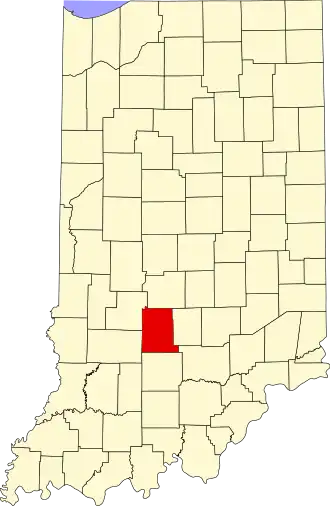
Monroe County (Indiana)
| County in de Verenigde Staten | |||
|---|---|---|---|
| |||
| Situering | |||
| Staat | Indiana | ||
| Coördinaten | 39°9'36"NB, 86°31'12"WL | ||
| Algemeen | |||
| Oppervlakte | 1.065 km² | ||
| - land | 1.021 km² | ||
| - water | 44 km² | ||
| Inwoners (2000) |
120.563 (118 inw./km²) | ||
| Overig | |||
| Zetel | Bloomington | ||
| FIPS-code | 18105 | ||
| Opgericht | 1818 | ||
| Website | www | ||
| Foto's | |||

| |||
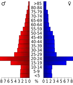 Bevolkingspiramide Monroe County | |||
| Statistieken volkstelling Monroe County | |||
| |||
Monroe County is een county in de Amerikaanse staat Indiana.
De county heeft een landoppervlakte van 1.021 km² en telt 120.563 inwoners (volkstelling 2000). De hoofdplaats is Bloomington.
Bevolkingsontwikkeling
| Jaar | Inwoners | % ± | |
|---|---|---|---|
| 1900 | 20.873 | — | |
| 1910 | 23.426 | 12,2% | |
| 1920 | 24.519 | 4,7% | |
| 1930 | 35.974 | 46,7% | |
| 1940 | 36.534 | 1,6% | |
| 1950 | 50.080 | 37,1% | |
| 1960 | 59.225 | 18,3% | |
| 1970 | 84.849 | 43,3% | |
| 1980 | 98.785 | 16,4% | |
| 1990 | 108.978 | 10,3% | |
| 2000 | 120.563 | 10,6% | |
| Bron: (en) Historical Decennial Census Population | |||