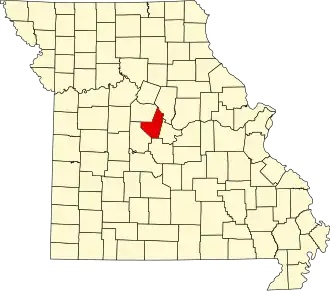
Moniteau County
| County in de Verenigde Staten | |||
|---|---|---|---|
| |||
| Situering | |||
| Staat | Missouri | ||
| Coördinaten | 38°37'48"NB, 92°34'48"WL | ||
| Algemeen | |||
| Oppervlakte | 1.085 km² | ||
| - land | 1.079 km² | ||
| - water | 6 km² | ||
| Inwoners (2000) |
14.827 (14 inw./km²) | ||
| Overig | |||
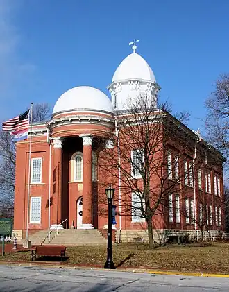
| Zetel | California | ||
| FIPS-code | 29135 | ||
| Opgericht | 1845 | ||
| Website | www | ||
| Foto's | |||
| |||
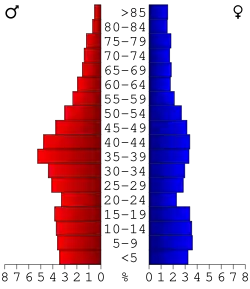 Bevolkingspiramide Moniteau County | |||
| Statistieken volkstelling Moniteau County | |||
| |||
Moniteau County is een county in de Amerikaanse staat Missouri.
De county heeft een landoppervlakte van 1.079 km² en telt 14.827 inwoners (volkstelling 2000). De hoofdplaats is California.
Bevolkingsontwikkeling
| Jaar | Inwoners | % ± | |
|---|---|---|---|
| 1900 | 15.931 | — | |
| 1910 | 14.375 | −9,8% | |
| 1920 | 13.532 | −5,9% | |
| 1930 | 12.173 | −10,0% | |
| 1940 | 11.775 | −3,3% | |
| 1950 | 10.840 | −7,9% | |
| 1960 | 10.500 | −3,1% | |
| 1970 | 10.742 | 2,3% | |
| 1980 | 12.068 | 12,3% | |
| 1990 | 12.298 | 1,9% | |
| 2000 | 14.827 | 20,6% | |
| Bron: (en) Historical Decennial Census Population | |||