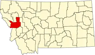
Missoula County
| County in de Verenigde Staten | |||
|---|---|---|---|
| |||
| Situering | |||
| Staat | Montana | ||
| Coördinaten | 47°2'24"NB, 113°55'48"WL | ||
| Algemeen | |||
| Oppervlakte | 6.782 km² | ||
| - land | 6.729 km² | ||
| - water | 53 km² | ||
| Inwoners (2000) |
95.802 (14 inw./km²) | ||
| Overig | |||
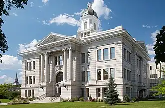
| Zetel | Missoula | ||
| FIPS-code | 30063 | ||
| Opgericht | 1864 | ||
| Website | www | ||
| Foto's | |||
| |||
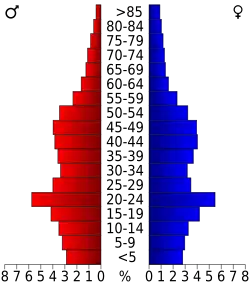 Bevolkingspiramide Missoula County | |||
| Statistieken volkstelling Missoula County | |||
| |||
Missoula County is een county in de Amerikaanse staat Montana.
De county heeft een landoppervlakte van 6.729 km² en telt 95.802 inwoners (volkstelling 2000). De hoofdplaats is Missoula.
Bevolkingsontwikkeling
| Jaar | Inwoners | % ± | |
|---|---|---|---|
| 1900 | 13.964 | — | |
| 1910 | 23.596 | 69,0% | |
| 1920 | 24.041 | 1,9% | |
| 1930 | 21.782 | −9,4% | |
| 1940 | 29.038 | 33,3% | |
| 1950 | 35.493 | 22,2% | |
| 1960 | 44.663 | 25,8% | |
| 1970 | 58.263 | 30,5% | |
| 1980 | 76.016 | 30,5% | |
| 1990 | 78.687 | 3,5% | |
| 2000 | 95.802 | 21,8% | |
| Bron: (en) Historical Decennial Census Population | |||
Zie de categorie Missoula County, Montana van Wikimedia Commons voor mediabestanden over dit onderwerp.
Geboren
- Jeannette Rankin (1880-1973), politica