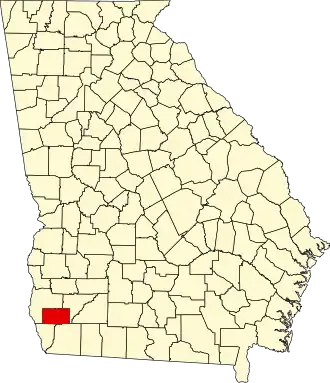
Miller County (Georgia)
| County in de Verenigde Staten | |||
|---|---|---|---|
| |||
| Situering | |||
| Staat | Georgia | ||
| Coördinaten | 31°9'36"NB, 84°43'48"WL | ||
| Algemeen | |||
| Oppervlakte | 735 km² | ||
| - land | 733 km² | ||
| - water | 2 km² | ||
| Inwoners (2000) |
6.383 (9 inw./km²) | ||
| Overig | |||
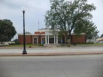
| Zetel | Colquitt | ||
| FIPS-code | 13201 | ||
| Opgericht | 1856 | ||
| Website | www | ||
| Foto's | |||
| |||
 Bevolkingspiramide Miller County | |||
| Statistieken volkstelling Miller County | |||
| |||
Miller County is een county in de Amerikaanse staat Georgia.
De county heeft een landoppervlakte van 733 km² en telt 6.383 inwoners (volkstelling 2000). De hoofdplaats is Colquitt.
Bevolkingsontwikkeling
| Jaar | Inwoners | % ± | |
|---|---|---|---|
| 1900 | 6.319 | — | |
| 1910 | 7.986 | 26,4% | |
| 1920 | 9.565 | 19,8% | |
| 1930 | 9.076 | −5,1% | |
| 1940 | 9.998 | 10,2% | |
| 1950 | 9.023 | −9,8% | |
| 1960 | 6.908 | −23,4% | |
| 1970 | 6.397 | −7,4% | |
| 1980 | 7.038 | 10,0% | |
| 1990 | 6.280 | −10,8% | |
| 2000 | 6.383 | 1,6% | |
| Bron: (en) Historical Decennial Census Population | |||