Meriwether County
| County in de Verenigde Staten | |||
|---|---|---|---|
| |||
| Situering | |||
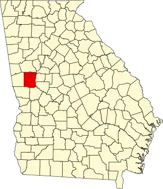
| Staat | Georgia | ||
| Coördinaten | 33°2'24"NB, 84°41'24"WL | ||
| Algemeen | |||
| Oppervlakte | 1.308 km² | ||
| - land | 1.303 km² | ||
| - water | 5 km² | ||
| Inwoners (2000) |
22.534 (17 inw./km²) | ||
| Overig | |||
| Zetel | Greenville | ||
| FIPS-code | 13199 | ||
| Opgericht | 1827 | ||
| Website | meriwethercountyga | ||
| Foto's | |||

| |||
 Bevolkingspiramide Meriwether County | |||
| Statistieken volkstelling Meriwether County | |||
| |||
Meriwether County is een county in de Amerikaanse staat Georgia.
De county heeft een landoppervlakte van 1.303 km² en telt 22.534 inwoners (volkstelling 2000). De hoofdplaats is Greenville.
Bevolkingsontwikkeling
| Jaar | Inwoners | % ± | |
|---|---|---|---|
| 1900 | 23.339 | — | |
| 1910 | 25.180 | 7,9% | |
| 1920 | 26.168 | 3,9% | |
| 1930 | 22.437 | −14,3% | |
| 1940 | 22.055 | −1,7% | |
| 1950 | 21.055 | −4,5% | |
| 1960 | 19.756 | −6,2% | |
| 1970 | 19.461 | −1,5% | |
| 1980 | 21.229 | 9,1% | |
| 1990 | 22.411 | 5,6% | |
| 2000 | 22.534 | 0,5% | |
| Bron: (en) Historical Decennial Census Population | |||