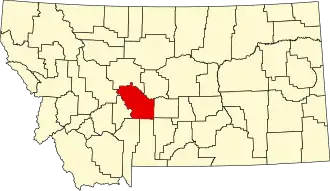
Meagher County
| County in de Verenigde Staten | |||
|---|---|---|---|
| |||
| Situering | |||
| Staat | Montana | ||
| Coördinaten | 46°48'47"NB, 111°12'36"WL | ||
| Algemeen | |||
| Oppervlakte | 6.203 km² | ||
| - land | 6.195 km² | ||
| - water | 8 km² | ||
| Inwoners (2000) |
1.932 (0 inw./km²) | ||
| Overig | |||
| Zetel | White Sulphur Springs | ||
| FIPS-code | 30059 | ||
| Opgericht | 1867 | ||
| Website | www | ||
| Foto's | |||

| |||
 Bevolkingspiramide Meagher County | |||
| Statistieken volkstelling Meagher County | |||
| |||
Meagher County is een county in de Amerikaanse staat Montana.
De county heeft een landoppervlakte van 6.195 km² en telt 1.932 inwoners (volkstelling 2000). De hoofdplaats is White Sulphur Springs.
Bevolkingsontwikkeling
| Jaar | Inwoners | % ± | |
|---|---|---|---|
| 1900 | 2.526 | — | |
| 1910 | 4.190 | 65,9% | |
| 1920 | 2.622 | −37,4% | |
| 1930 | 2.272 | −13,3% | |
| 1940 | 2.237 | −1,5% | |
| 1950 | 2.079 | −7,1% | |
| 1960 | 2.616 | 25,8% | |
| 1970 | 2.122 | −18,9% | |
| 1980 | 2.154 | 1,5% | |
| 1990 | 1.819 | −15,6% | |
| 2000 | 1.932 | 6,2% | |
| Bron: (en) Historical Decennial Census Population | |||