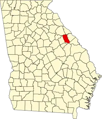
McDuffie County
| County in de Verenigde Staten | |||
|---|---|---|---|
| |||
| Situering | |||
| Staat | Georgia | ||
| Coördinaten | 33°28'48"NB, 82°28'48"WL | ||
| Algemeen | |||
| Oppervlakte | 690 km² | ||
| - land | 673 km² | ||
| - water | 17 km² | ||
| Inwoners (2000) |
21.231 (32 inw./km²) | ||
| Overig | |||
| Zetel | Thomson | ||
| FIPS-code | 13189 | ||
| Opgericht | 1870 | ||
| Website | www | ||
| Foto's | |||

| |||
 Bevolkingspiramide McDuffie County | |||
| Statistieken volkstelling McDuffie County | |||
| |||
McDuffie County is een county in de Amerikaanse staat Georgia.
De county heeft een landoppervlakte van 673 km² en telt 21.231 inwoners (volkstelling 2000). De hoofdplaats is Thomson.
Bevolkingsontwikkeling
| Jaar | Inwoners | % ± | |
|---|---|---|---|
| 1900 | 9.804 | — | |
| 1910 | 10.325 | 5,3% | |
| 1920 | 11.509 | 11,5% | |
| 1930 | 9.014 | −21,7% | |
| 1940 | 10.878 | 20,7% | |
| 1950 | 11.443 | 5,2% | |
| 1960 | 12.627 | 10,3% | |
| 1970 | 15.276 | 21,0% | |
| 1980 | 18.546 | 21,4% | |
| 1990 | 20.119 | 8,5% | |
| 2000 | 21.231 | 5,5% | |
| Bron: (en) Historical Decennial Census Population | |||