Mason County (Michigan)
| County in de Verenigde Staten | |||
|---|---|---|---|
| |||
| Situering | |||
| Staat | Michigan | ||
| Coördinaten | 44°1'12"NB, 86°30'0"WL | ||
| Algemeen | |||
| Oppervlakte | 3.216 km² | ||
| - land | 1.282 km² | ||
| - water | 1.934 km² | ||
| Inwoners (2000) |
28.274 (22 inw./km²) | ||
| Overig | |||
| Zetel | Ludington | ||
| FIPS-code | 26105 | ||
| Opgericht | 1840 | ||
| Website | masoncounty | ||
| Foto's | |||

| |||
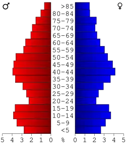 Bevolkingspiramide Mason County | |||
| Statistieken volkstelling Mason County | |||
| |||
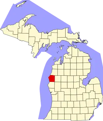
Mason County is een county in de Amerikaanse staat Michigan.
De county heeft een landoppervlakte van 1.282 km² en telt 28.274 inwoners (volkstelling 2000). De hoofdplaats is Ludington.
Bevolkingsontwikkeling
| Jaar | Inwoners | % ± | |
|---|---|---|---|
| 1900 | 18.885 | — | |
| 1910 | 21.832 | 15,6% | |
| 1920 | 19.831 | −9,2% | |
| 1930 | 18.756 | −5,4% | |
| 1940 | 19.378 | 3,3% | |
| 1950 | 20.474 | 5,7% | |
| 1960 | 21.929 | 7,1% | |
| 1970 | 22.612 | 3,1% | |
| 1980 | 26.365 | 16,6% | |
| 1990 | 25.537 | −3,1% | |
| 2000 | 28.274 | 10,7% | |
| Bron: (en) Historical Decennial Census Population | |||