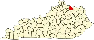
Mason County (Kentucky)
| County in de Verenigde Staten | |||
|---|---|---|---|
| |||
| Situering | |||
| Staat | Kentucky | ||
| Coördinaten | 38°36'0"NB, 83°49'48"WL | ||
| Algemeen | |||
| Oppervlakte | 638 km² | ||
| - land | 624 km² | ||
| - water | 14 km² | ||
| Inwoners (2000) |
16.800 (27 inw./km²) | ||
| Overig | |||
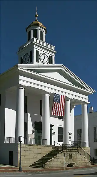
| Zetel | Maysville | ||
| FIPS-code | 21161 | ||
| Opgericht | 1788 | ||
| Website | www | ||
| Foto's | |||
| |||
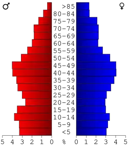 Bevolkingspiramide Mason County | |||
| Statistieken volkstelling Mason County | |||
| |||
Mason County is een county in de Amerikaanse staat Kentucky.
De county heeft een landoppervlakte van 624 km² en telt 16.800 inwoners (volkstelling 2000). De hoofdplaats is Maysville.
Bevolkingsontwikkeling
| Jaar | Inwoners | % ± | |
|---|---|---|---|
| 1900 | 20.446 | — | |
| 1910 | 18.611 | −9,0% | |
| 1920 | 17.760 | −4,6% | |
| 1930 | 18.862 | 6,2% | |
| 1940 | 19.066 | 1,1% | |
| 1950 | 18.486 | −3,0% | |
| 1960 | 18.454 | −0,2% | |
| 1970 | 17.273 | −6,4% | |
| 1980 | 17.765 | 2,8% | |
| 1990 | 16.666 | −6,2% | |
| 2000 | 16.800 | 0,8% | |
| Bron: (en) Historical Decennial Census Population | |||
Geboren
- Albert Sidney Johnston (Washington, 1803-1862), beroepsofficier en Zuidelijke generaal tijdens de Amerikaanse Burgeroorlog
- Roy Bean (ca. 1825-1903), roemruchte rechter uit het Wilde Westen