Marion County (Missouri)
| County in de Verenigde Staten | |||
|---|---|---|---|
| |||
| Situering | |||
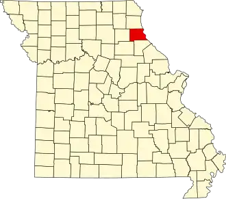
| Staat | Missouri | ||
| Coördinaten | 39°48'36"NB, 91°37'12"WL | ||
| Algemeen | |||
| Oppervlakte | 1.150 km² | ||
| - land | 1.135 km² | ||
| - water | 15 km² | ||
| Inwoners (2000) |
28.289 (25 inw./km²) | ||
| Overig | |||
| Zetel | Palmyra. | ||
| FIPS-code | 29127 | ||
| Opgericht | 1826 | ||
| Website | marioncountymo | ||
| Foto's | |||

| |||
 Bevolkingspiramide Marion County | |||
| Statistieken volkstelling Marion County | |||
| |||
Marion County is een county in de Amerikaanse staat Missouri.
De county heeft een landoppervlakte van 1.135 km² en telt 28.289 inwoners (volkstelling 2000). De hoofdplaats is Palmyra.
Bevolkingsontwikkeling
| Jaar | Inwoners | % ± | |
|---|---|---|---|
| 1900 | 26.331 | — | |
| 1910 | 30.572 | 16,1% | |
| 1920 | 30.226 | −1,1% | |
| 1930 | 33.493 | 10,8% | |
| 1940 | 31.576 | −5,7% | |
| 1950 | 29.765 | −5,7% | |
| 1960 | 29.522 | −0,8% | |
| 1970 | 28.121 | −4,7% | |
| 1980 | 28.638 | 1,8% | |
| 1990 | 27.682 | −3,3% | |
| 2000 | 28.289 | 2,2% | |
| Bron: (en) Historical Decennial Census Population | |||
Zie de categorie Marion County, Missouri van Wikimedia Commons voor mediabestanden over dit onderwerp.