Marion County (Indiana)
| County in de Verenigde Staten | |||
|---|---|---|---|
| |||
| Situering | |||
| Staat | Indiana | ||
| Coördinaten | 39°46'48"NB, 86°8'24"WL | ||
| Algemeen | |||
| Oppervlakte | 1.044 km² | ||
| - land | 1.026 km² | ||
| - water | 18 km² | ||
| Inwoners (2000) |
860.454 (839 inw./km²) | ||
| Overig | |||
| Zetel | Indianapolis | ||
| FIPS-code | 18097 | ||
| Opgericht | 1822 | ||
| Website | www | ||
| Foto's | |||
_exterior.jpg)
| |||
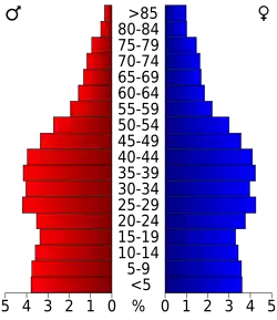 Bevolkingspiramide Marion County | |||
| Statistieken volkstelling Marion County | |||
| |||
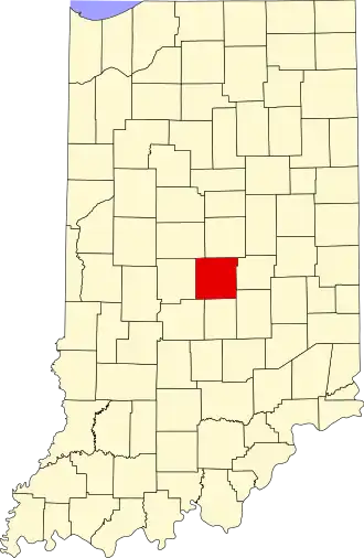
Marion County is een county in de Amerikaanse staat Indiana.
De county heeft een landoppervlakte van 1.026 km² en telt 860.454 inwoners (volkstelling 2000). De hoofdplaats is Indianapolis.
Bevolkingsontwikkeling
| Jaar | Inwoners | % ± | |
|---|---|---|---|
| 1900 | 197.227 | — | |
| 1910 | 263.661 | 33,7% | |
| 1920 | 348.061 | 32,0% | |
| 1930 | 422.666 | 21,4% | |
| 1940 | 460.926 | 9,1% | |
| 1950 | 551.777 | 19,7% | |
| 1960 | 697.567 | 26,4% | |
| 1970 | 792.299 | 13,6% | |
| 1980 | 765.233 | −3,4% | |
| 1990 | 797.159 | 4,2% | |
| 2000 | 860.454 | 7,9% | |
| Bron: (en) Historical Decennial Census Population | |||