Marion County (Florida)
| County in de Verenigde Staten | |||
|---|---|---|---|
| |||
| Situering | |||
| Staat | Florida | ||
| Coördinaten | 29°12'36"NB, 82°3'36"WL | ||
| Algemeen | |||
| Oppervlakte | 4.307 km² | ||
| - land | 4.089 km² | ||
| - water | 218 km² | ||
| Inwoners (2000) |
258.916 (63 inw./km²) | ||
| Overig | |||
| Zetel | Ocala | ||
| FIPS-code | 12083 | ||
| Opgericht | 1844 | ||
| Website | www | ||
| Foto's | |||
.JPG)
| |||
 Bevolkingspiramide Marion County | |||
| Statistieken volkstelling Marion County | |||
| |||
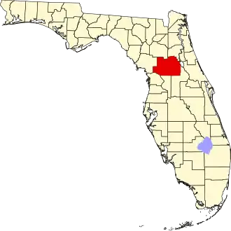
Marion County is een county in de Amerikaanse staat Florida.
De county heeft een landoppervlakte van 4.089 km² en telt 258.916 inwoners (volkstelling 2000). De hoofdplaats is Ocala.
Bevolkingsontwikkeling
| Jaar | Inwoners | % ± | |
|---|---|---|---|
| 1900 | 24.403 | — | |
| 1910 | 26.941 | 10,4% | |
| 1920 | 23.968 | −11,0% | |
| 1930 | 29.578 | 23,4% | |
| 1940 | 31.243 | 5,6% | |
| 1950 | 38.187 | 22,2% | |
| 1960 | 51.616 | 35,2% | |
| 1970 | 69.030 | 33,7% | |
| 1980 | 122.488 | 77,4% | |
| 1990 | 194.833 | 59,1% | |
| 2000 | 258.916 | 32,9% | |
| Bron: (en) Historical Decennial Census Population | |||