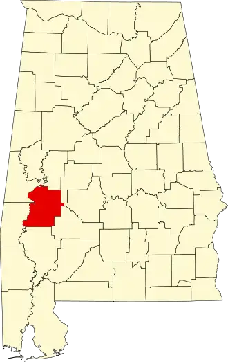
Marengo County
| County in de Verenigde Staten | |||
|---|---|---|---|
| |||
| Situering | |||
| Staat | Alabama | ||
| Coördinaten | 32°14'31"NB, 87°47'22"WL | ||
| Algemeen | |||
| Oppervlakte | 2.546 km² | ||
| - land | 2.531 km² | ||
| - water | 15 km² | ||
| Inwoners (2000) |
22.539 (9 inw./km²) | ||
| Overig | |||
| Zetel | Linden | ||
| FIPS-code | 01091 | ||
| Opgericht | 1818 | ||
| Website | marengocountyal | ||
| Foto's | |||

| |||
 Bevolkingspiramide Marengo County | |||
| Statistieken volkstelling Marengo County | |||
| |||
Marengo County is een county in de Amerikaanse staat Alabama.
De county heeft een landoppervlakte van 2.531 km² en telt 22.539 inwoners (volkstelling 2000). De hoofdplaats is Linden.
Bevolkingsontwikkeling
| Jaar | Inwoners | % ± | |
|---|---|---|---|
| 1900 | 38.315 | — | |
| 1910 | 39.923 | 4,2% | |
| 1920 | 36.065 | −9,7% | |
| 1930 | 36.426 | 1,0% | |
| 1940 | 35.736 | −1,9% | |
| 1950 | 29.494 | −17,5% | |
| 1960 | 27.098 | −8,1% | |
| 1970 | 23.819 | −12,1% | |
| 1980 | 25.047 | 5,2% | |
| 1990 | 23.084 | −7,8% | |
| 2000 | 22.539 | −2,4% | |
| Bron: (en) Historical Decennial Census Population | |||