Madison County (Mississippi)
| County in de Verenigde Staten | |||
|---|---|---|---|
| |||
| Situering | |||
| Staat | Mississippi | ||
| Coördinaten | 32°37'48"NB, 90°1'48"WL | ||
| Algemeen | |||
| Oppervlakte | 1.921 km² | ||
| - land | 1.857 km² | ||
| - water | 64 km² | ||
| Inwoners (2000) |
74.674 (40 inw./km²) | ||
| Overig | |||
| Zetel | Canton | ||
| FIPS-code | 28089 | ||
| Opgericht | 1828 | ||
| Website | www | ||
| Foto's | |||

| |||
 Bevolkingspiramide Madison County | |||
| Statistieken volkstelling Madison County | |||
| |||
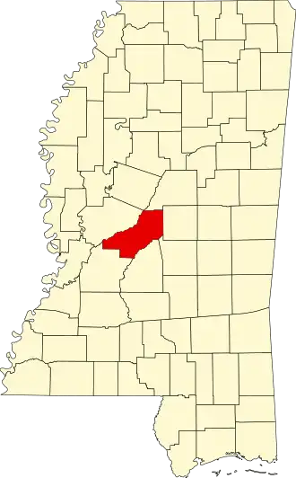
Madison County is een county in de Amerikaanse staat Mississippi.
De county heeft een landoppervlakte van 1.857 km² en telt 74.674 inwoners (volkstelling 2000). De hoofdplaats is Canton.
Bevolkingsontwikkeling
| Jaar | Inwoners | % ± | |
|---|---|---|---|
| 1900 | 32.493 | — | |
| 1910 | 33.505 | 3,1% | |
| 1920 | 29.292 | −12,6% | |
| 1930 | 35.796 | 22,2% | |
| 1940 | 37.504 | 4,8% | |
| 1950 | 33.860 | −9,7% | |
| 1960 | 32.904 | −2,8% | |
| 1970 | 29.737 | −9,6% | |
| 1980 | 41.613 | 39,9% | |
| 1990 | 53.794 | 29,3% | |
| 2000 | 74.674 | 38,8% | |
| Bron: (en) Historical Decennial Census Population | |||