Longeville-lès-Saint-Avold
| Gemeente in Frankrijk | |||
|---|---|---|---|
 | |||
| Situering | |||
| Regio | Grand Est | ||
| Departement | Moselle (57) | ||
| Arrondissement | Forbach-Boulay-Moselle | ||
| Kanton | Faulquemont | ||
| Coördinaten | 49° 7′ NB, 6° 38′ OL | ||
| Algemeen | |||
| Oppervlakte | 24,54 km² | ||
| Inwoners (1 januari 2022) |
3.592[1] (146 inw./km²) | ||
| Hoogte | 228 - 411 m | ||
| Overig | |||
| Postcode | 57740 | ||
| INSEE-code | 57413 | ||
| Website | Officiële website | ||
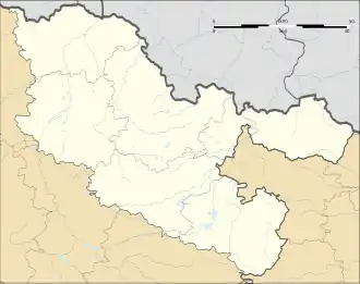
| Detailkaart | |||
 | |||
| Foto's | |||
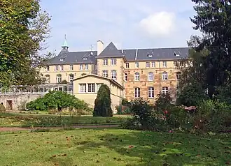
| |||
| Abbaye Saint-Martin-des-Glandières | |||
| |||
Longeville-lès-Saint-Avold (Duits: Lungenfeld bei Sankt Avold) is een gemeente in het Franse departement Moselle (regio Grand Est). De plaats maakt deel uit van het arrondissement Forbach-Boulay-Moselle. Longeville-lès-Saint-Avold telde op 1 januari 2022 3.592[1] inwoners.
Geografie
De oppervlakte van Longeville-lès-Saint-Avold bedroeg op 1 januari 2022 24,54 vierkante kilometer; de bevolkingsdichtheid was toen 146,4 inwoners per km².
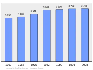
Demografie
Onderstaande figuur toont het verloop van het inwonertal (bron: INSEE-tellingen).
Externe links
- Informatie over Longeville-lès-Saint-Avold
- (fr) Statistische informatie op de website van het Franse bureau voor statistiek INSEE
Zie de categorie Longeville-lès-Saint-Avold van Wikimedia Commons voor mediabestanden over dit onderwerp.