Haringey
| Borough van Londen | |||
|---|---|---|---|
 | |||
| |||
| Situering | |||
| Land | Engeland | ||
| County | Outer London | ||
| Regio | London | ||
| Coördinaten | 51°36'0"NB, 0°6'43"WL | ||
| Algemeen | |||
| Oppervlakte | 29,5983[1] km² | ||
| Inwoners (2018[2]) |
270.624 (9143 inw./km²) | ||
| ONS-code | E09000014 | ||
| Website | www | ||
| |||
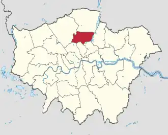
Haringey (London Borough of Haringey) is een Engels district of borough in de regio Groot-Londen, gelegen in het noorden van de metropool. De borough telt 271.224 inwoners. De oppervlakte bedraagt 30 km².
Van de bevolking is 9,8% ouder dan 65 jaar. De werkloosheid bedraagt 5,8% van de beroepsbevolking (cijfers volkstelling 2001).
Wijken in Haringey
Bronnen, noten en/of referenties
- ↑ Office for National Statistics → Download → SAM_for_Administrative_Areas_(2018).zip → SAM_LAD_DEC_2018_UK.xlsx. Gearchiveerd op 12 juni 2023.
- ↑ https://www.ons.gov.uk/file?uri=/peoplepopulationandcommunity/populationandmigration/populationestimates/datasets/populationestimatesforukenglandandwalesscotlandandnorthernireland/mid20182019laboundaries/ukmidyearestimates20182019ladcodes.xls Schatting Office for National Statistics: knop MYE5 → kolom Estimated Population mid-2018]