Livingston County (Michigan)
| County in de Verenigde Staten | |||
|---|---|---|---|
| |||
| Situering | |||
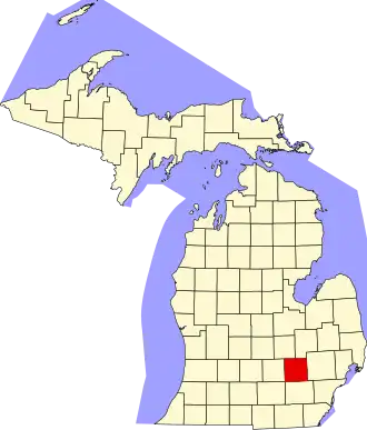
| Staat | Michigan | ||
| Coördinaten | 42°36'0"NB, 83°54'36"WL | ||
| Algemeen | |||
| Oppervlakte | 1.516 km² | ||
| - land | 1.472 km² | ||
| - water | 44 km² | ||
| Inwoners (2000) |
156.951 (107 inw./km²) | ||
| Overig | |||
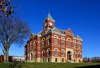
| Zetel | Howell | ||
| FIPS-code | 26093 | ||
| Opgericht | 1836 | ||
| Website | www | ||
| Foto's | |||
| |||
 Bevolkingspiramide Livingston County | |||
| Statistieken volkstelling Livingston County | |||
| |||
Livingston County is een county in de Amerikaanse staat Michigan.
De county heeft een landoppervlakte van 1.472 km² en telt 156.951 inwoners (volkstelling 2000). De hoofdplaats is Howell.
Bevolkingsontwikkeling
| Jaar | Inwoners | % ± | |
|---|---|---|---|
| 1900 | 19.664 | — | |
| 1910 | 17.736 | −9,8% | |
| 1920 | 17.522 | −1,2% | |
| 1930 | 19.274 | 10,0% | |
| 1940 | 20.863 | 8,2% | |
| 1950 | 26.725 | 28,1% | |
| 1960 | 38.233 | 43,1% | |
| 1970 | 58.967 | 54,2% | |
| 1980 | 100.289 | 70,1% | |
| 1990 | 115.645 | 15,3% | |
| 2000 | 156.951 | 35,7% | |
| Bron: (en) Historical Decennial Census Population | |||