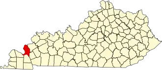
Livingston County (Kentucky)
| County in de Verenigde Staten | |||
|---|---|---|---|
| |||
| Situering | |||
| Staat | Kentucky | ||
| Coördinaten | 37°12'36"NB, 88°21'0"WL | ||
| Algemeen | |||
| Oppervlakte | 887 km² | ||
| - land | 819 km² | ||
| - water | 68 km² | ||
| Inwoners (2000) |
9.804 (12 inw./km²) | ||
| Overig | |||
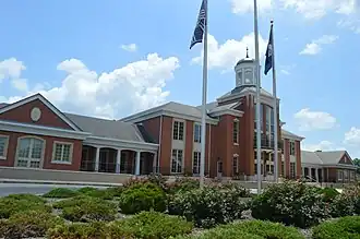
| Zetel | Smithland | ||
| FIPS-code | 21139 | ||
| Opgericht | 1798 | ||
| Website | www | ||
| Foto's | |||
| |||
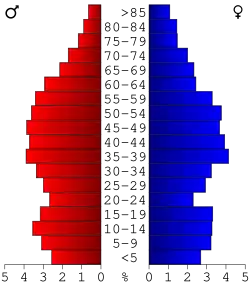 Bevolkingspiramide Livingston County | |||
| Statistieken volkstelling Livingston County | |||
| |||
Livingston County is een county in de Amerikaanse staat Kentucky.
De county heeft een landoppervlakte van 819 km² en telt 9.804 inwoners (volkstelling 2000). De hoofdplaats is Smithland en de dichtstbevolkte stad is Salem, maar de dichtstbevolkte gemeenschap is de census-designated place van Ledbetter.
Bevolkingsontwikkeling
| Jaar | Inwoners | % ± | |
|---|---|---|---|
| 1900 | 11.354 | — | |
| 1910 | 10.627 | −6,4% | |
| 1920 | 9.732 | −8,4% | |
| 1930 | 8.608 | −11,5% | |
| 1940 | 9.127 | 6,0% | |
| 1950 | 7.184 | −21,3% | |
| 1960 | 7.029 | −2,2% | |
| 1970 | 7.596 | 8,1% | |
| 1980 | 9.219 | 21,4% | |
| 1990 | 9.062 | −1,7% | |
| 2000 | 9.804 | 8,2% | |
| Bron: (en) Historical Decennial Census Population | |||