Lijst van monumenten op Sint Eustatius
Dit is een lijst van beschermde en niet beschermde monumenten op Sint Eustatius. De monumenten bevinden zich in de historische kern van Oranjestad en daarbuiten.
| Nr. | Object | Locatie | Adres | Kadaster | Coördinaten | Afbeelding |
|---|---|---|---|---|---|---|
| C01 | Old Church begraafplaats | Aan de oostelijke rand van de bovenstad | Merkmanweg / hoek Lodi Road | |||
| C02 | Joodse begraafplaats | Aan de oostelijke rand van de bovenstad | zuidoostelijk hoek Merkman Weg en Princess Weg | 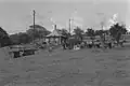 | ||
| C04 | Anglicaanse begraafplaats | Binckesweg | 17° 28' 51" NB, 62° 59' 4" WL |
|||
| C08 | Rooms-katholieke begraafplaats | Van Tonningenweg | ||||
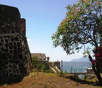
| F01 | Fort Oranje (ook: Old Fort, Fort George, Fort Hollandia) | RB 8 / 1954 | 17° 28' 56" NB, 62° 59' 11" WL |
 | ||
| F02 | Four Gun Battery (gebouwd als Bourbon Battery; ook: Battery Vaughan) | |||||
| F03 | Waterfort (ook: Nieuwe Fort (?), Hollandia (?), Fort/Battery Amsterdam, St. Anna Batterij, Fort Waterloo) | Aan het noordelijke uiteinde van Lower Town, voorbij Smoke Alley, in de buurt van de Godet Plantage |  | |||
| F04 | Rotterdam Battery, Nieuwe Fort | Gebied genaamd Van Zanten's Land | ||||
| F05 | Battery Royal (ook: Fort Nassau) | Op de top van de zuidwestelijke rand van de Horseshoe bergen | ||||
| F06 | Fort Panga (ook: Signal Hil, Seinpost, La Vigie) | Boven het oostelijke uiteinde van de Horseshoe bergen | .jpg) | |||
| F08 | Tumble Down Dick Battery (ook: Tommelendijk, Battery Charlotte) | In het midden van de haven van de olieterminal en pijpleidingen | ||||
| F10 | St. Louis Battery (ook: Lucie) | Op de klif boven Compagnie Bay | ||||
| F11 | Corre Corre Battery (ook: Couroucorou) | Op de klif aan het zuidoostelijke einde van Corre Corre Bay | 17° 28' 49" NB, 62° 56' 48" WL |
 | ||
| F12 | De Windt Battery (ook: Fort de Windt, Back-off Battery, Lisburne Battery) | Op de klif aan het einde van de weg naar White Wall | 17° 27' 57" NB, 62° 57' 45" WL |
 | ||
| F14 | Nassau Battery (ook: Fort Nassau) | Op de klifrand in de noordelijke hoek van Kay Bay | ||||
| F15 | Dolijn Battery (ook: Batterie La Haye) | Op de klifzijde, halverwege tussen de batterijen Nassau en Bouille | ||||
| F17 | Bouillé Battery (ook: Battery Citern) | Aan de rand van de klif, aan het zuidelijke einde van de gut die leidt tot Crooks | ||||
| L01 | Lower Town, on either side of the northern end of the Bay Road between Smoke Alley and Sampson's Well | Bay Road | ||||
| L02 | Lower Town, on the sea side of Bay Road between Sampson's Well and warehouse | |||||
| L03 | Lower Town, on the cliff side of Bay Road between Sampson's Well and the Bay Path | Bay Road | ||||
| L04 | Lower Town, on the cliff side of Bay Road between Bay Path and the Old Gin House Hotel | Bay Road | ||||
| L05 | Lower Town, on either side of the Bay Road between the Old Gin House Hotel/Golden Era Hotel and the drainage gutter just north of the Blue Bead Restaurant | Bay Road | ||||
| L06 | Lower Town, on the sea side of the Bay Road between the drainage gutter just north of the Blue Bead Restaurant and the small pier | Bay Road | ||||
| L07 | Old Gin House | Lower Town, on the northern 'bank' of Claes Gut. | Bay Road | 17° 28' 55" NB, 62° 59' 14" WL |
 | |
| L08 | Customs House, Guard House[1] | In de historische kern van Oranjestad | Bay Road (voor de Old Pier) | |||
| L09 | Lower Town, on the Bay Road between the double warehouse (L12) and the seaside terrace of the Old Gin House Hotel | Bay Road | ||||
| L10 | ||||||
| L11 | Bay Road | |||||
| L12 | Tweelaags pakhuis | |||||
| L13 | Ruine[2] | |||||
| L14 | Path | Bay Road | ||||
| L15 | Lower Town, from Smoke Alley to the Waterfort (Fort Amsterdam) |  | ||||
| L16 | Smoke Alley | Lower Town, at the very northern end of the Bay Road where it starts to curve upwards | Bay Road | |||
| L17 | Crooks Castle | Gallows Bay, about one-and-a-half mile south of the large pier |  | |||
| L18 | Old Pier | Lower Town, stretching from the Customs House into the sea | Bay Road |  | ||
| M12 | Wilhelmina Monument | In de historische kern van Oranjestad, op de voormalige "Old Market' | Paramiraweg/Damsteeg | _regeringsjubileum_van_Koningin_Wilhelmina_Sint_Eustatius_Boy_Lawson_(Fotograaf).jpg) | ||
| P01 | Plantage Zeelandia | Country side, area called Zeelandia | ||||
| P02 | Princess | At the top of Oranjestad, little more than 50 meters from the end of Prinsesweg | ||||
| P04 | Calabash Tree Plantage/Concordia Plantage | At the northern end of Concordia Road | Concordia Road | |||
| P06 | Little Round Hill Hill House | |||||
| P07 | Sisal Factory | Road to White Wall |  | |||
| P08 | Bouillé Plantage | Road to White Wall |  | |||
| P09 | Schotsenhoek plantage | RB 8 / 1954 | ||||
| P10 | Godet Plantage | Godet | .jpg) | |||
| P12 | The Mansion | Mansionweg | 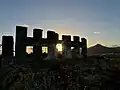 | |||
| P13 | Glass Bottle Plantage | Glass Bottle | ||||
| P14 | Pleasures Plantage | Pleasures | ||||
| P15 | Fair Play plantage en suikermolen | Fair Play | 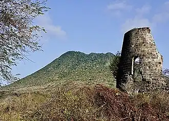 | |||
| P16 | Tumble Down Dick Plantage/Anna's Lust | |||||
| P17 | English Quarter Plantage |  | ||||
| R01 | Bay Path (ook Old Path, Hill Head) | Bay Path | ||||
| R02 | New Path, Nieuwe Pad, Tompy Hill Head | New Path | ||||
| U01 | Doncker House, Donckers Nieuwe Tempel | In de historische kern van Oranjestad | Wilhelminastraat | RB 8/1951 (RB 7/1951?) | 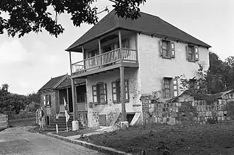 | |
| U02 | Madam's | In de historische kern van Oranjestad | Wilhelminaweg - Fort Oranjestraat | CA 10 / 1978 | ||
| U03 | Deep Yard | In de historische kern van Oranjestad | Paramiraweg (3?) | RB 8/1950 | 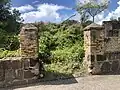 | |
| U04 | Het Tuinhuisje | In de historische kern van Oranjestad | Rost van Tonningenweg 11 | RB7/1949 | ||
| U05 | Monuments Office | In de historische kern van Oranjestad | Rost van Tonningenweg 13 | CA 9/1978 | ||
| U06 | Paper Corner | In de historische kern van Oranjestad | Rost van Tonningenweg 15 | CA 9/1978 | ||
| U07 | Berkel's House | In de historische kern van Oranjestad | Fort Oranjestraat 1 | C4 /74, C9 /110 | ||
| U08 | Government Guesthouse gebouw | In de historische kern van Oranjestad | Fort Oranjestraat |  | ||
| U09 | The Cottage | In de historische kern van Oranjestad | Cottageweg | |||
| U10 | Hill Compound, Three Widows Corner, Old Library) | In de historische kern van Oranjestad | Fort Oranjestraat 2-4 | MB 3 / 1964 |  | |
| U11 | In de historische kern van Oranjestad | Fort Oranjestraat 6 | MB K2 / 1961, E3 150 | |||
| U12 | In de historische kern van Oranjestad | Fort Oranjestraat 8 | RB 8/1949 | |||
| U13 | Gezaghebber's House | In de historische kern van Oranjestad | Kerkweg 1 | RB 7/1954 | ||
| U14 | Volk's House | In de historische kern van Oranjestad | Kerkweg 4 | C 14/75 | ||
| U15 | Van Putten's House | In de historische kern van Oranjestad | Kerkweg 6 | C 19/8 | ||
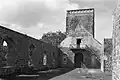
| U16 | Nederlands Hervormde kerk en begraafplaats | In de historische kern van Oranjestad | Kerkweg | 17° 28' 53" NB, 62° 59' 9" WL |
 | |
| U17 | Huis van Timmer | Bovenstad, Oranjestad | Kerkweg | |||
| U18 | (Pompier's House) | Kerkweg 25 | ||||
| U21 | Wilhelmina Park | Wilhelmina Park | 17° 28' 51" NB, 62° 59' 7" WL |
|||
| U22 | Duinkerk's House | In de historische kern van Oranjestad | hoek Synagogepad/Evertsweg | MB 9/1964 | 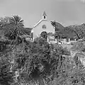 | |
| U23 | Mozes' House | In de historische kern van Oranjestad | hoek Kerkweg/Evertsweg | E2/285 | ||
| U24 | Johnson Compound | In de historische kern van Oranjestad | Fort Oranjestraat (12?), Bredeweg (2?), Synagogepad (5?) | E3 / 30 | 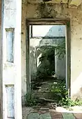 | |
| U25 | Synagogue Honen Dalim | In de historische kern van Oranjestad | Synagogepad | 17° 28' 57" NB, 62° 58' 53" WL |
 | |
| U26 | Evening Rest | In de historische kern van Oranjestad met de voorkant naar het Synagogepad en de achterkant naar Bredeweg | Synagogepad 9 | E3/30 | ||
| U27 | (Miss Olive Woods' House) | In de historische kern van Oranjestad | Bredeweg 4 | E3/52 | ||
| U28 | Mussenden House, also Miss Consie's House or Voges House | In de historische kern van Oranjestad | Bredeweg | 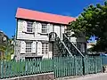 | ||
| U29 | Zeezicht, Catholic club house | In de historische kern van Oranjestad recht op de klif boven de Bay Path, op het terrein van de Rooms-Katholieke Kerk | Van Tonningenweg | RB 10/1950 (C5/15, C6/44, C6/81, C6/86, C6/87, C9/86, C9/87, C9/88, C9/90, C11/88, C11/154) | ||
| U30 | (Ellis' House)[3] | Hoek Logeweg/Prinsesweg | 17° 28' 55" NB, 62° 59' 2" WL |
|||
| U32 | Schmidt's House | Fort Oranjestraat (East corner Faeschweg) | 17° 28' 58" NB, 62° 59' 0" WL |
|||
| U33 | Original Fruit Tree Restaurant | Prinsesweg 5 | 17° 28' 54" NB, 62° 59' 2" WL |
|||
| U34 | Doctor's House (also Old Museum) | Prinsesweg 23 | ||||
| U35 | Barber shop | Hoek Kruisweg/Prinsesweg (nr. 17?) |  | |||
| U37 | (Stella Hassel's house) | Kapelweg (on the lower end of the south side) | ||||
| U38 | Old Public School | Bredeweg between Binckesweg and Vannesweg | ||||
| U39 | China House | Northeast corner Vannesweg/E.C. Flander Road | ||||
| U40 | Old Allruns | Flander Road (21?) | ||||
| U41 | Pandt's House | Prinsesweg, south side, between Black Harry Lane and Kruisweg | ||||
| U42 | (Miss Busby's storage house, also Miss Louise's house) | In de historische kern van Oranjestad | Prinsesweg (1?) | RB 4/1948; E3/27 | ||
| U43 | Miss Busby's House | In de historische kern van Oranjestad | Prinsesweg 3 | E4/94 | ||
| U44 | Cassidor's House | In de historische kern van Oranjestad | Kerkweg 2 | RB 3/1947 | ||
| U45 | In de historische kern van Oranjestad | hoek Bredeweg/Evertsweg | ||||
| U46 | In de historische kern van Oranjestad | Synagogepad 11 | ||||
| U47 | Van Zanten's grocery | In de historische kern van Oranjestad | Kerkweg | RB9/1950; E3/97 | ||
| U48 | Hillman's House | Fort Oranjestraat/corner Logeweg | 17° 28' 57" NB, 62° 59' 3" WL |
|||
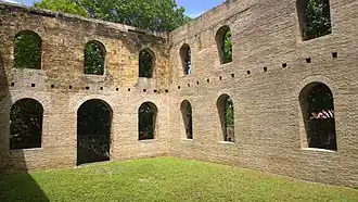
| U50 | Lutheran church ruins | Vannesweg, op het perceel van het land tussen E.C. Flander Road and Black Harry Lane | ||||
| U52 | Roman Catholic Church of St. Eustatius | In de historische kern van Oranjestad, op de "Old Market,' bovenaan het Bay Path | Paramiraweg | RB 10/1950 (C5/15, C6/44, C6/81, C6/86, C6/87, C9/85, C9/86, C9/87, C9/88, C9/90, C11/88, C11/154) | 17° 28' 59" NB, 62° 59' 12" WL |
|
| U53 | Glover's House | In de historische kern van Oranjestad | Paramiraweg 1 | CA 9/1978 | ||
| U54 | In de historische kern van Oranjestad | Van Tonningenweg? | ||||
| U55 | Cool Corner | historische kern Oranjestad | Emmaweg | RB 7/1947 | 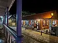 | |
| U56 | In de historische kern van Oranjestad | Fort Oranjestraat 3 | C19/8 | |||
| U57 | (The Nursery) | Breedeweg/ south corner Prinsesweg | 17° 28' 54" NB, 62° 59' 6" WL |
|||
| U58 | (Park Place) | In de historische kern van Oranjestad | C 8/97 | 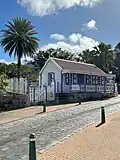 | ||
| U59 | Huis van Sprott | In de historische kern van Oranjestad | Wilhelminaweg 1 | C 8/97 | 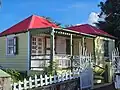 | |
| U60 | Old Market | Paramiraweg/Damsteeg | ||||
| U63 | Bethel Methodist kerk[4] | Corner Black Harry Lane and Kapelweg | 17° 28' 52" NB, 62° 59' 2" WL |
![Bethel Methodist kerk[4]](./Entrance_to_the_Bethel_Methodist_Church%252C_Oranjestad%252C_Sint_Eustatius.jpg) | ||
| U67 | In de historische kern van Oranjestad | Paramiraweg (5?) | E2/298 | |||
| U68 | Old Catholic School + Hole in the Wall | Van Tonningenweg | RB 10/1950 (C5/15, C6/44, C6/81, C6/86, C6/87, C9/85, C9/86, C9/87, C9/88, C9/90, C11/88, C11/154) | |||
| U69 | In de historisch kern van Oranjestad | Emmaweg, aan de achterkant van Cool Corner | C6/1 | |||
| U70 | (Green and White Cove) | In de historische kern van Oranjestad | Fort Oranjestraat 10 | RB 4/1956; E2/272 |  | |
| U71 | In de historische kern van Oranjestad | Wilhelminaweg 3 | ||||
| U72 | In de historische kern van Oranjestad | Kerkweg, achter de Sand Box Bakery links, op hetzelfde perceel | ||||
| U73 | In the beginning of the eastern Upper Town extension of 1739/1740, adjacent to the Methodist church yard on Kapelweg | Kapelweg | ||||
| U74 | DP building | Centrum van Bovenstad, Oranjestad | Fort Oranjestraat | |||
| U75 | Centrum van Bovenstad, Oranjestad | Fort Oranjestraat | ||||
| U76 | Madam Theatre | In de historische kern van Oranjestad | Fort Oranjestraat 11 | E-7/124 | .jpg) | |
| W01 | Taylor's Well | On the cliff side of the Bay Road, towards its northern end | On the West side of Black Harry Lane, near the junction with Binkesweg | |||
| W02 | Samson's Well (also Sampson's Well) | Aan de klifzijde van de Bay Road, naar het noordelijke uiteinde | Bay Road | |||
| W04 | King's Well | In de bocht van het noordelijke uiteinde van Bay Road | Bay Road | 17° 29' 9" NB, 62° 59' 28" WL |
Bronnen, noten en/of referenties
- Dit artikel of een eerdere versie ervan is een (gedeeltelijke) vertaling van het artikel List of protected buildings in Sint Eustatius op de Engelstalige Wikipedia, dat onder de licentie Creative Commons Naamsvermelding/Gelijk delen valt. Zie de bewerkingsgeschiedenis aldaar.
- ↑ https://lokaleregelgeving.overheid.nl/CVDR359143. Gearchiveerd op 3 november 2023.
- ↑ https://lokaleregelgeving.overheid.nl/CVDR359149. Gearchiveerd op 3 november 2023.
- ↑ https://lokaleregelgeving.overheid.nl/CVDR359141. Gearchiveerd op 3 november 2023.
- ↑ https://lokaleregelgeving.overheid.nl/CVDR446196. Gearchiveerd op 3 november 2023.