Lewis County (Missouri)
| County in de Verenigde Staten | |||
|---|---|---|---|
| |||
| Situering | |||
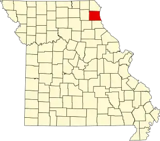
| Staat | Missouri | ||
| Coördinaten | 40°5'24"NB, 91°43'48"WL | ||
| Algemeen | |||
| Oppervlakte | 1.323 km² | ||
| - land | 1.308 km² | ||
| - water | 15 km² | ||
| Inwoners (2000) |
10.494 (8 inw./km²) | ||
| Overig | |||
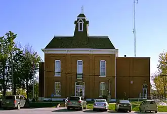
| Zetel | Monticello | ||
| FIPS-code | 29111 | ||
| Opgericht | 1833 | ||
| Website | lewiscountymo | ||
| Foto's | |||
| |||
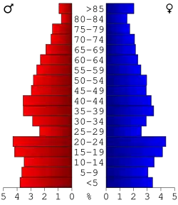 Bevolkingspiramide Lewis County | |||
| Statistieken volkstelling Lewis County | |||
| |||
Lewis County is een county in de Amerikaanse staat Missouri.
De county heeft een landoppervlakte van 1.308 km² en telt 10.494 inwoners (volkstelling 2000). De hoofdplaats is Monticello.
Bevolkingsontwikkeling
| Jaar | Inwoners | % ± | |
|---|---|---|---|
| 1900 | 16.724 | — | |
| 1910 | 15.514 | −7,2% | |
| 1920 | 13.465 | −13,2% | |
| 1930 | 12.093 | −10,2% | |
| 1940 | 11.490 | −5,0% | |
| 1950 | 10.733 | −6,6% | |
| 1960 | 10.984 | 2,3% | |
| 1970 | 10.993 | 0,1% | |
| 1980 | 10.901 | −0,8% | |
| 1990 | 10.233 | −6,1% | |
| 2000 | 10.494 | 2,6% | |
| Bron: (en) Historical Decennial Census Population | |||
Zie de categorie Lewis County, Missouri van Wikimedia Commons voor mediabestanden over dit onderwerp.