Lewis County (Kentucky)
| County in de Verenigde Staten | |||
|---|---|---|---|
| |||
| Situering | |||
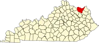
| Staat | Kentucky | ||
| Coördinaten | 38°31'48"NB, 83°23'24"WL | ||
| Algemeen | |||
| Oppervlakte | 1.284 km² | ||
| - land | 1.255 km² | ||
| - water | 29 km² | ||
| Inwoners (2000) |
14.092 (11 inw./km²) | ||
| Overig | |||
| Zetel | Vanceburg | ||
| FIPS-code | 21135 | ||
| Opgericht | 1806 | ||
| Website | www | ||
| Foto's | |||

| |||
 Bevolkingspiramide Lewis County | |||
| Statistieken volkstelling Lewis County | |||
| |||
Lewis County is een county in de Amerikaanse staat Kentucky.
De county heeft een landoppervlakte van 1.255 km² en telt 14.092 inwoners (volkstelling 2000). De hoofdplaats is Vanceburg.
Bevolkingsontwikkeling
| Jaar | Inwoners | % ± | |
|---|---|---|---|
| 1900 | 17.868 | — | |
| 1910 | 16.887 | −5,5% | |
| 1920 | 15.829 | −6,3% | |
| 1930 | 14.315 | −9,6% | |
| 1940 | 15.686 | 9,6% | |
| 1950 | 13.520 | −13,8% | |
| 1960 | 13.115 | −3,0% | |
| 1970 | 12.355 | −5,8% | |
| 1980 | 14.545 | 17,7% | |
| 1990 | 13.029 | −10,4% | |
| 2000 | 14.092 | 8,2% | |
| Bron: (en) Historical Decennial Census Population | |||