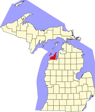
Leelanau County
| County in de Verenigde Staten | |||
|---|---|---|---|
| |||
| Situering | |||
| Staat | Michigan | ||
| Coördinaten | 45°7'48"NB, 86°1'48"WL | ||
| Algemeen | |||
| Oppervlakte | 6.559 km² | ||
| - land | 903 km² | ||
| - water | 5.656 km² | ||
| Inwoners (2000) |
21.119 (23 inw./km²) | ||
| Overig | |||
| Zetel | Leland | ||
| FIPS-code | 26089 | ||
| Opgericht | 1840 | ||
| Website | www | ||
| Foto's | |||
.jpg)
| |||
 Bevolkingspiramide Leelanau County | |||
| Statistieken volkstelling Leelanau County | |||
| |||
Leelanau County is een county in de Amerikaanse staat Michigan.
De county heeft een landoppervlakte van 903 km² en telt 21.119 inwoners (volkstelling 2000). De hoofdplaats is Leland.
Bevolkingsontwikkeling
| Jaar | Inwoners | % ± | |
|---|---|---|---|
| 1900 | 10.556 | — | |
| 1910 | 10.608 | 0,5% | |
| 1920 | 9.061 | −14,6% | |
| 1930 | 8.206 | −9,4% | |
| 1940 | 8.436 | 2,8% | |
| 1950 | 8.647 | 2,5% | |
| 1960 | 9.321 | 7,8% | |
| 1970 | 10.872 | 16,6% | |
| 1980 | 14.007 | 28,8% | |
| 1990 | 16.527 | 18,0% | |
| 2000 | 21.119 | 27,8% | |
| Bron: (en) Historical Decennial Census Population | |||