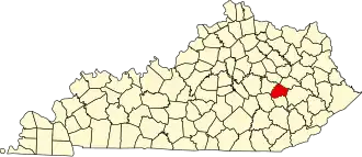
Lee County (Kentucky)
| County in de Verenigde Staten | |||
|---|---|---|---|
| |||
| Situering | |||
| Staat | Kentucky | ||
| Coördinaten | 37°35'24"NB, 83°43'12"WL | ||
| Algemeen | |||
| Oppervlakte | 548 km² | ||
| - land | 544 km² | ||
| - water | 4 km² | ||
| Inwoners (2000) |
7.916 (15 inw./km²) | ||
| Overig | |||
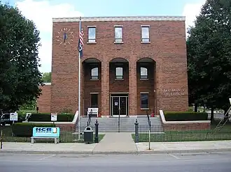
| Zetel | Beattyville | ||
| FIPS-code | 21129 | ||
| Opgericht | 1870 | ||
| Website | www | ||
| Foto's | |||
| |||
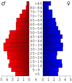 Bevolkingspiramide Lee County | |||
| Statistieken volkstelling Lee County | |||
| |||
Lee County is een county in de Amerikaanse staat Kentucky.
De county heeft een landoppervlakte van 544 km² en telt 7.916 inwoners (volkstelling 2000). De hoofdplaats is Beattyville.
Bevolkingsontwikkeling
| Jaar | Inwoners | % ± | |
|---|---|---|---|
| 1900 | 7.988 | — | |
| 1910 | 9.531 | 19,3% | |
| 1920 | 11.918 | 25,0% | |
| 1930 | 9.729 | −18,4% | |
| 1940 | 10.860 | 11,6% | |
| 1950 | 8.739 | −19,5% | |
| 1960 | 7.420 | −15,1% | |
| 1970 | 6.587 | −11,2% | |
| 1980 | 7.754 | 17,7% | |
| 1990 | 7.422 | −4,3% | |
| 2000 | 7.916 | 6,7% | |
| Bron: (en) Historical Decennial Census Population | |||