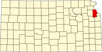
Leavenworth County
| County in de Verenigde Staten | |||
|---|---|---|---|
| |||
| Situering | |||
| Staat | Kansas | ||
| Coördinaten | 39°16'7"NB, 95°7'32"WL | ||
| Algemeen | |||
| Oppervlakte | 1.213 km² | ||
| - land | 1.200 km² | ||
| - water | 13 km² | ||
| Inwoners (2000) |
68.691 (57 inw./km²) | ||
| Overig | |||
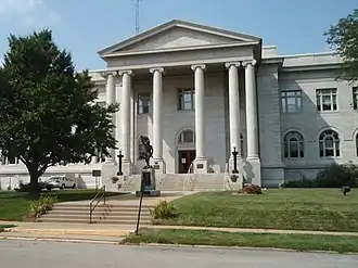
| Zetel | Leavenworth | ||
| FIPS-code | 20103 | ||
| Opgericht | 1855 | ||
| Website | www | ||
| Foto's | |||
| |||
 Bevolkingspiramide Leavenworth County | |||
| Statistieken volkstelling Leavenworth County | |||
| |||
Leavenworth County is een county in de Amerikaanse staat Kansas.
De county heeft een landoppervlakte van 1.200 km² en telt 68.691 inwoners (volkstelling 2000). De hoofdplaats is Leavenworth.
Bevolkingsontwikkeling
| Jaar | Inwoners | % ± | |
|---|---|---|---|
| 1900 | 40.940 | — | |
| 1910 | 41.207 | 0,7% | |
| 1920 | 38.402 | −6,8% | |
| 1930 | 42.673 | 11,1% | |
| 1940 | 41.112 | −3,7% | |
| 1950 | 42.361 | 3,0% | |
| 1960 | 48.524 | 14,5% | |
| 1970 | 53.340 | 9,9% | |
| 1980 | 54.809 | 2,8% | |
| 1990 | 64.371 | 17,4% | |
| 2000 | 68.691 | 6,7% | |
| Bron: (en) Historical Decennial Census Population | |||