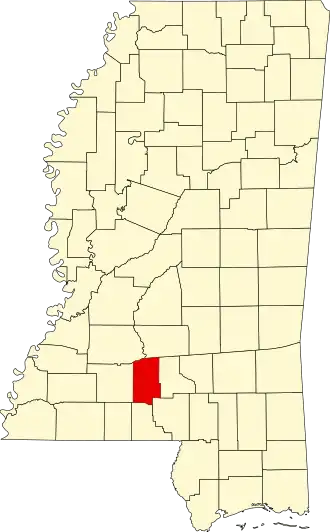
Lawrence County (Mississippi)
| County in de Verenigde Staten | |||
|---|---|---|---|
| |||
| Situering | |||
| Staat | Mississippi | ||
| Coördinaten | 31°33'0"NB, 90°6'36"WL | ||
| Algemeen | |||
| Oppervlakte | 1.128 km² | ||
| - land | 1.115 km² | ||
| - water | 13 km² | ||
| Inwoners (2000) |
13.258 (12 inw./km²) | ||
| Overig | |||
| Zetel | Monticello | ||
| FIPS-code | 28077 | ||
| Opgericht | 1814 | ||
| Website | lawrencecountyms | ||
| Foto's | |||

| |||
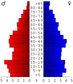 Bevolkingspiramide Lawrence County | |||
| Statistieken volkstelling Lawrence County | |||
| |||
Lawrence County is een county in de Amerikaanse staat Mississippi.
De county heeft een landoppervlakte van 1.115 km² en telt 13.258 inwoners (volkstelling 2000). De hoofdplaats is Monticello.
Bevolkingsontwikkeling
| Jaar | Inwoners | % ± | |
|---|---|---|---|
| 1900 | 15.103 | — | |
| 1910 | 13.080 | −13,4% | |
| 1920 | 12.663 | −3,2% | |
| 1930 | 12.471 | −1,5% | |
| 1940 | 13.983 | 12,1% | |
| 1950 | 12.639 | −9,6% | |
| 1960 | 10.215 | −19,2% | |
| 1970 | 11.137 | 9,0% | |
| 1980 | 12.518 | 12,4% | |
| 1990 | 12.458 | −0,5% | |
| 2000 | 13.258 | 6,4% | |
| Bron: (en) Historical Decennial Census Population | |||