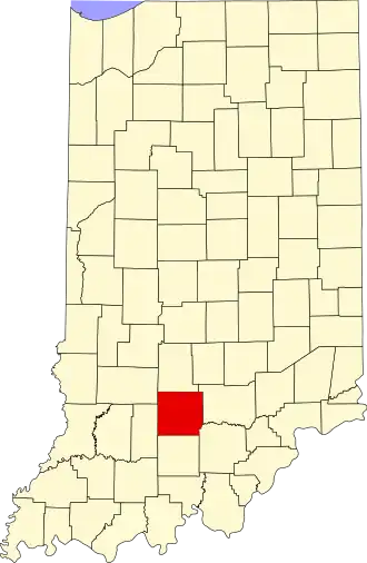
Lawrence County (Indiana)
| County in de Verenigde Staten | |||
|---|---|---|---|
| |||
| Situering | |||
| Staat | Indiana | ||
| Coördinaten | 38°50'24"NB, 86°29'24"WL | ||
| Algemeen | |||
| Oppervlakte | 1.170 km² | ||
| - land | 1.162 km² | ||
| - water | 8 km² | ||
| Inwoners (2000) |
45.922 (40 inw./km²) | ||
| Overig | |||
| Zetel | Bedford | ||
| FIPS-code | 18093 | ||
| Opgericht | 1818 | ||
| Website | lawrencecounty | ||
| Foto's | |||

| |||
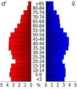 Bevolkingspiramide Lawrence County | |||
| Statistieken volkstelling Lawrence County | |||
| |||
Lawrence County is een county in de Amerikaanse staat Indiana.
De county heeft een landoppervlakte van 1.162 km² en telt 45.922 inwoners (volkstelling 2000). De hoofdplaats is Bedford.
Bevolkingsontwikkeling
| Jaar | Inwoners | % ± | |
|---|---|---|---|
| 1900 | 25.729 | — | |
| 1910 | 30.625 | 19,0% | |
| 1920 | 28.228 | −7,8% | |
| 1930 | 35.583 | 26,1% | |
| 1940 | 35.045 | −1,5% | |
| 1950 | 34.346 | −2,0% | |
| 1960 | 36.564 | 6,5% | |
| 1970 | 38.038 | 4,0% | |
| 1980 | 42.472 | 11,7% | |
| 1990 | 42.836 | 0,9% | |
| 2000 | 45.922 | 7,2% | |
| Bron: (en) Historical Decennial Census Population | |||