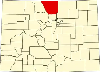
Larimer County
| County in de Verenigde Staten | |||
|---|---|---|---|
| |||
| Situering | |||
| Staat | Colorado | ||
| Coördinaten | 40°39'0"NB, 105°27'36"WL | ||
| Algemeen | |||
| Oppervlakte | 6.821 km² | ||
| - land | 6.737 km² | ||
| - water | 84 km² | ||
| Inwoners (2000) |
251.494 (37 inw./km²) | ||
| Overig | |||
| Zetel | Fort Collins | ||
| FIPS-code | 08069 | ||
| Opgericht | 1861 | ||
| Website | www | ||
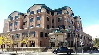
| Foto's | |||
| |||
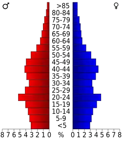 Bevolkingspiramide Larimer County | |||
| Statistieken volkstelling Larimer County | |||
| |||
Larimer County is een county in de Amerikaanse staat Colorado.
De county heeft een landoppervlakte van 6.737 km² en telt 251.494 inwoners (volkstelling 2000). De hoofdplaats is Fort Collins.
Bevolkingsontwikkeling
| Jaar | Inwoners | % ± | |
|---|---|---|---|
| 1900 | 12.168 | — | |
| 1910 | 25.270 | 107,7% | |
| 1920 | 27.872 | 10,3% | |
| 1930 | 33.137 | 18,9% | |
| 1940 | 35.539 | 7,2% | |
| 1950 | 43.554 | 22,6% | |
| 1960 | 53.343 | 22,5% | |
| 1970 | 89.900 | 68,5% | |
| 1980 | 149.184 | 65,9% | |
| 1990 | 186.136 | 24,8% | |
| 2000 | 251.494 | 35,1% | |
| Bron: (en) Historical Decennial Census Population | |||