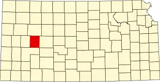
Lane County (Kansas)
| County in de Verenigde Staten | |||
|---|---|---|---|
| |||
| Situering | |||
| Staat | Kansas | ||
| Coördinaten | 38°28'0,1"NB, 100°28'1,2"WL | ||
| Algemeen | |||
| Oppervlakte | 1.859 km² | ||
| - land | 1.858 km² | ||
| - water | 1 km² | ||
| Inwoners (2000) |
2.155 (1 inw./km²) | ||
| Overig | |||
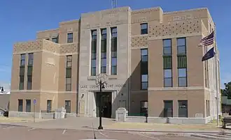
| Zetel | Dighton | ||
| FIPS-code | 20101 | ||
| Opgericht | 1873 | ||
| Website | www | ||
| Foto's | |||
| |||
 Bevolkingspiramide Lane County | |||
| Statistieken volkstelling Lane County | |||
| |||
Lane County is een county in de Amerikaanse staat Kansas.
De county heeft een landoppervlakte van 1.858 km² en telt 2.155 inwoners (volkstelling 2000). De hoofdplaats is Dighton.
Bevolkingsontwikkeling
| Jaar | Inwoners | % ± | |
|---|---|---|---|
| 1900 | 1.563 | — | |
| 1910 | 2.603 | 66,5% | |
| 1920 | 2.848 | 9,4% | |
| 1930 | 3.372 | 18,4% | |
| 1940 | 2.821 | −16,3% | |
| 1950 | 2.808 | −0,5% | |
| 1960 | 3.060 | 9,0% | |
| 1970 | 2.707 | −11,5% | |
| 1980 | 2.472 | −8,7% | |
| 1990 | 2.375 | −3,9% | |
| 2000 | 2.155 | −9,3% | |
| Bron: (en) Historical Decennial Census Population | |||