Lamjung (district)
| District in Nepal | |||
|---|---|---|---|
 | |||
| |||
| Situering | |||
| Regio | Western (WDR) | ||
| Zone | Gandaki | ||
| Coördinaten | 28°14'0"NB, 84°23'0"OL | ||
| Algemeen | |||
| Oppervlakte | 1692 km² | ||
| Inwoners (2011) |
167.724[1] (99 inw./km²) | ||
| Hoofdstad | Besishahar | ||
| Overig | |||
| Website | Officiële website | ||
| Foto's | |||
| |||
| |||
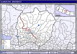
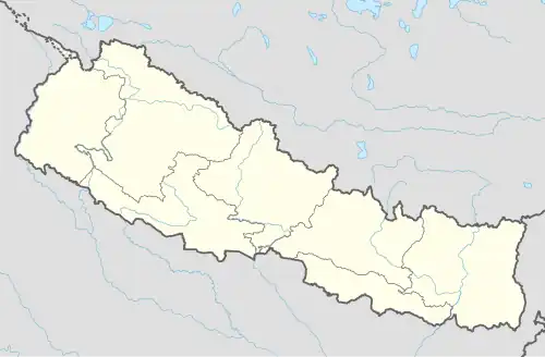
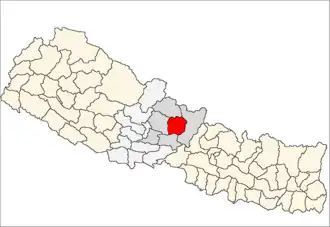
Lamjung (Nepalees: लमजुङ) is een van de 75 districten van Nepal. Het district is gelegen in de bestuurlijke zone Gandaki en de hoofdstad is Besishahar.
- Stad: Nepalees: nagarpalika of N.P.; Engels: municipality;
- Dorpscommissie: Nepalees: panchayat; Engels: village development committee of VDC.
- Steden (0): geen.
- Dorpscommissies (61): Archalbot, Bahundanda, Bajhakhet, Balungpani, Bangre, Bansar, Besishahar, Bhalayakharka, Bharte, Bhoje, Bhorletar, Bhoteoodar (of: Bhote Odar), Bhujung, Bhulbhule, Bichaur, Chakratirtha, Chandisthan, Chandreshwor, Chiti, Dhamilikuwa, Dhodeni, Dhuseni, Dudhpokhari, Duradanda, Faleni, Gauda (of: Gaunda), Gaunshahar, Ghanpokhara, Ghermu, Gilunng, Hiletaksar, Ilampokhari, Isaneshwor (of: Ishaneshwor), Jita, Karapu, Khudi, Kolki, Kunchha, Maling, Mohoriyakot, Nalma, Nauthar, Neta, Pachok, Parewadada (of: Parewadanda), Pasagaun, Puranokot (of: Purankot), Pyarjung, Ramgha, Samibhanjyang, Shree Bhanjyang, Simpani, Sindure, Sundarbazar, Suryapal, Taghringre (of: Taghring), Tandrang (Taksar) (of: Tangrang Taksar), Tarku, Tarkughat, Udipur, Uttarkanya (of: Uttar Kanya).
Bronnen, noten en/of referenties
- ↑ Census 2011: Final Results p. 63.
- ↑ Min. Fed. Zaken en Lok. Ontwikk.: Lijst van steden (N.P.s) vanaf p. 2 en dorpscommissies (VDCs) p. 44.
- ↑ Min. Fed. Zaken en Lok. Ontwikk.: Wegenkaart en kaart van steden (N.P. of municipality) en dorpscommissies
Zie de categorie Lamjung District van Wikimedia Commons voor mediabestanden over dit onderwerp.