Kenton County
| County in de Verenigde Staten | |||
|---|---|---|---|

| |||
| Situering | |||
| Staat | Kentucky | ||
| Coördinaten | 38°55'48"NB, 84°32'24"WL | ||
| Algemeen | |||
| Oppervlakte | 426 km² | ||
| - land | 420 km² | ||
| - water | 6 km² | ||
| Inwoners (2000) |
151.464 (361 inw./km²) | ||
| Overig | |||
| Zetel | Covington en Independence | ||
| FIPS-code | 21117 | ||
| Opgericht | 1840 | ||
| Website | kentoncounty | ||
| Foto's | |||

| |||
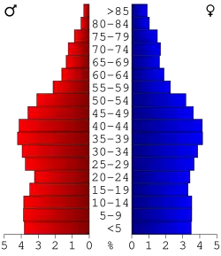 Bevolkingspiramide Kenton County | |||
| Statistieken volkstelling Kenton County | |||
| |||
Kenton County is een county in de Amerikaanse staat Kentucky.
De county heeft een landoppervlakte van 420 km² en telt 151.464 inwoners (volkstelling 2000). De hoofdsteden zijn Covington en Independence.
Bevolkingsontwikkeling
| Jaar | Inwoners | % ± | |
|---|---|---|---|
| 1900 | 63.591 | — | |
| 1910 | 70.355 | 10,6% | |
| 1920 | 73.453 | 4,4% | |
| 1930 | 93.534 | 27,3% | |
| 1940 | 93.139 | −0,4% | |
| 1950 | 104.254 | 11,9% | |
| 1960 | 120.700 | 15,8% | |
| 1970 | 129.440 | 7,2% | |
| 1980 | 137.058 | 5,9% | |
| 1990 | 142.031 | 3,6% | |
| 2000 | 151.464 | 6,6% | |
| Bron: (en) Historical Decennial Census Population | |||