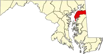
Kent County (Maryland)
| County in de Verenigde Staten | |||
|---|---|---|---|
| |||
| Situering | |||
| Staat | Maryland | ||
| Coördinaten | 39°13'48"NB, 76°6'0"WL | ||
| Algemeen | |||
| Oppervlakte | 1.073 km² | ||
| - land | 724 km² | ||
| - water | 349 km² | ||
| Inwoners (2000) |
19.197 (27 inw./km²) | ||
| Overig | |||
| Zetel | Chestertown | ||
| FIPS-code | 24029 | ||
| Opgericht | 1642 | ||
| Website | kentcounty | ||
| Foto's | |||

| |||
 Bevolkingspiramide Kent County | |||
| Statistieken volkstelling Kent County | |||
| |||
Kent County is een county in de Amerikaanse staat Maryland.
De county heeft een landoppervlakte van 724 km² en telt 19.197 inwoners (volkstelling 2000). De hoofdplaats is Chestertown.
Bevolkingsontwikkeling
| Jaar | Inwoners | % ± | |
|---|---|---|---|
| 1900 | 18.786 | — | |
| 1910 | 16.957 | −9,7% | |
| 1920 | 15.026 | −11,4% | |
| 1930 | 14.242 | −5,2% | |
| 1940 | 13.465 | −5,5% | |
| 1950 | 13.677 | 1,6% | |
| 1960 | 15.481 | 13,2% | |
| 1970 | 16.146 | 4,3% | |
| 1980 | 16.695 | 3,4% | |
| 1990 | 17.842 | 6,9% | |
| 2000 | 19.197 | 7,6% | |
| Bron: (en) Historical Decennial Census Population | |||