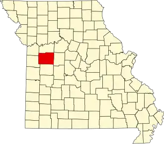
Johnson County (Missouri)
| County in de Verenigde Staten | |||
|---|---|---|---|
| |||
| Situering | |||
| Staat | Missouri | ||
| Coördinaten | 38°45'0"NB, 93°48'36"WL | ||
| Algemeen | |||
| Oppervlakte | 2.158 km² | ||
| - land | 2.151 km² | ||
| - water | 7 km² | ||
| Inwoners (2000) |
48.258 (22 inw./km²) | ||
| Overig | |||
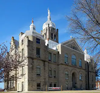
| Zetel | Warrensburg | ||
| FIPS-code | 29101 | ||
| Opgericht | 1834 | ||
| Website | www | ||
| Foto's | |||
| |||
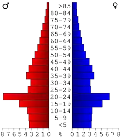 Bevolkingspiramide Johnson County | |||
| Statistieken volkstelling Johnson County | |||
| |||
Johnson County is een county in de Amerikaanse staat Missouri.
De county heeft een landoppervlakte van 2.151 km² en telt 48.258 inwoners (volkstelling 2000). De hoofdplaats is Warrensburg.
Bevolkingsontwikkeling
| Jaar | Inwoners | % ± | |
|---|---|---|---|
| 1900 | 27.843 | — | |
| 1910 | 26.297 | −5,6% | |
| 1920 | 24.899 | −5,3% | |
| 1930 | 22.413 | −10,0% | |
| 1940 | 21.617 | −3,6% | |
| 1950 | 20.716 | −4,2% | |
| 1960 | 28.981 | 39,9% | |
| 1970 | 34.172 | 17,9% | |
| 1980 | 39.059 | 14,3% | |
| 1990 | 42.514 | 8,8% | |
| 2000 | 48.258 | 13,5% | |
| Bron: (en) Historical Decennial Census Population | |||