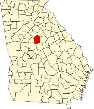
Jasper County (Georgia)
| County in de Verenigde Staten | |||
|---|---|---|---|
| |||
| Situering | |||
| Staat | Georgia | ||
| Coördinaten | 33°19'12"NB, 83°41'24"WL | ||
| Algemeen | |||
| Oppervlakte | 967 km² | ||
| - land | 959 km² | ||
| - water | 8 km² | ||
| Inwoners (2000) |
11.426 (12 inw./km²) | ||
| Overig | |||
| Zetel | Monticello | ||
| FIPS-code | 13159 | ||
| Opgericht | 1807 | ||
| Website | jaspercountyga | ||
| Foto's | |||

| |||
 Bevolkingspiramide Jasper County | |||
| Statistieken volkstelling Jasper County | |||
| |||
Jasper County is een county in de Amerikaanse staat Georgia.
De county heeft een landoppervlakte van 959 km² en telt 11.426 inwoners (volkstelling 2000). De hoofdplaats is Monticello.
Bevolkingsontwikkeling
| Jaar | Inwoners | % ± | |
|---|---|---|---|
| 1900 | 15.033 | — | |
| 1910 | 16.552 | 10,1% | |
| 1920 | 16.362 | −1,1% | |
| 1930 | 8.594 | −47,5% | |
| 1940 | 8.772 | 2,1% | |
| 1950 | 7.473 | −14,8% | |
| 1960 | 6.135 | −17,9% | |
| 1970 | 5.760 | −6,1% | |
| 1980 | 7.553 | 31,1% | |
| 1990 | 8.453 | 11,9% | |
| 2000 | 11.426 | 35,2% | |
| Bron: (en) Historical Decennial Census Population | |||