Itapipoca (gemeente)
| Gemeente in Brazilië | |||
|---|---|---|---|
  | |||
 | |||
| Situering | |||
| Regio | Noordoost | ||
| Staat | Ceará | ||
| Mesoregio | Norte Cearense | ||
| Microregio | Itapipoca | ||
| Coördinaten | 03° 30′ ZB, 39° 35′ WL | ||
| Algemeen | |||
| Oppervlakte | 1.614,682 km² | ||
| Inwoners (2017) |
127.465[1] (71,90 inw./km²) | ||
| Hoogte | 109 m | ||
| Gemeente nr. | 2306405 | ||
| Inwonersnaam | Itapipoquense | ||
| Politiek | |||
| Burgemeester | Felipe Souza Pinheiro (PT) (2021-2024) | ||
| Gesticht | 3 februari 1823 | ||
| Overig | |||
| Tijdzone | UTC−3 | ||
| HDI | 0,659 | ||
| Website | itapipoca.ce.gov.br | ||
| Detailkaart | |||
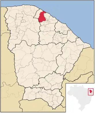
| |||
| Locatie van Itapipoca in de staat Ceará | |||
| Foto's | |||
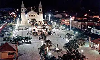
| |||
| Kathedraal Nossa Senhora das Mercês in Itapipoca | |||
| |||
Itapipoca is een gemeente in de Braziliaanse deelstaat Ceará. De gemeente telt 127.465 inwoners (schatting 2017).
De plaats is de zetel van het rooms-katholieke bisdom Itapipoca.
Aangrenzende gemeenten
De gemeente grenst aan Amontada, Irauçuba, Itapajé, Miraíma, Trairi, Tururu en Uruburetama.
Externe link
Bronnen, noten en/of referenties
- ↑ (pt) Estimativas de população 2017, Instituto Brasileiro de Geografia e Estatística. Geraadpleegd op 4 april 2018.
Zie de categorie Itapipoca van Wikimedia Commons voor mediabestanden over dit onderwerp.