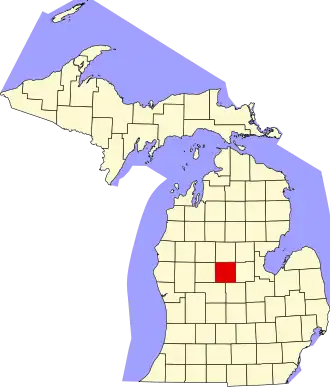
Isabella County
| County in de Verenigde Staten | |||
|---|---|---|---|
| |||
| Situering | |||
| Staat | Michigan | ||
| Coördinaten | 43°39'0"NB, 84°50'24"WL | ||
| Algemeen | |||
| Oppervlakte | 1.496 km² | ||
| - land | 1.487 km² | ||
| - water | 9 km² | ||
| Inwoners (2000) |
63.351 (43 inw./km²) | ||
| Overig | |||
| Zetel | Mount Pleasant | ||
| FIPS-code | 26073 | ||
| Opgericht | 1831 | ||
| Website | www | ||
| Foto's | |||

| |||
 Bevolkingspiramide Isabella County | |||
| Statistieken volkstelling Isabella County | |||
| |||
Isabella County is een county in de Amerikaanse staat Michigan.
De county heeft een landoppervlakte van 1.487 km² en telt 63.351 inwoners (volkstelling 2000). De hoofdplaats is Mount Pleasant
Bevolkingsontwikkeling
| Jaar | Inwoners | % ± | |
|---|---|---|---|
| 1900 | 22.784 | — | |
| 1910 | 23.029 | 1,1% | |
| 1920 | 22.610 | −1,8% | |
| 1930 | 21.126 | −6,6% | |
| 1940 | 25.982 | 23,0% | |
| 1950 | 28.964 | 11,5% | |
| 1960 | 35.348 | 22,0% | |
| 1970 | 44.594 | 26,2% | |
| 1980 | 54.110 | 21,3% | |
| 1990 | 54.624 | 0,9% | |
| 2000 | 63.351 | 16,0% | |
| Bron: (en) Historical Decennial Census Population | |||