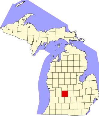
Ionia County
| County in de Verenigde Staten | |||
|---|---|---|---|
| |||
| Situering | |||
| Staat | Michigan | ||
| Coördinaten | 42°56'24"NB, 85°4'12"WL | ||
| Algemeen | |||
| Oppervlakte | 1.503 km² | ||
| - land | 1.485 km² | ||
| - water | 18 km² | ||
| Inwoners (2000) |
61.518 (41 inw./km²) | ||
| Overig | |||
| Zetel | Ionia | ||
| FIPS-code | 26067 | ||
| Opgericht | 1831 | ||
| Website | www | ||
| Foto's | |||

| |||
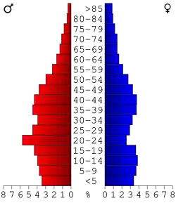 Bevolkingspiramide Ionia County | |||
| Statistieken volkstelling Ionia County | |||
| |||
Ionia County is een county in de Amerikaanse staat Michigan.
De county heeft een landoppervlakte van 1.485 km² en telt 61.518 inwoners (volkstelling 2000). De hoofdplaats is Ionia.
Bevolkingsontwikkeling
| Jaar | Inwoners | % ± | |
|---|---|---|---|
| 1900 | 34.329 | — | |
| 1910 | 33.550 | −2,3% | |
| 1920 | 33.087 | −1,4% | |
| 1930 | 35.093 | 6,1% | |
| 1940 | 35.710 | 1,8% | |
| 1950 | 38.158 | 6,9% | |
| 1960 | 43.132 | 13,0% | |
| 1970 | 45.848 | 6,3% | |
| 1980 | 51.815 | 13,0% | |
| 1990 | 57.024 | 10,1% | |
| 2000 | 61.518 | 7,9% | |
| Bron: (en) Historical Decennial Census Population | |||