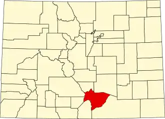
Huerfano County
| County in de Verenigde Staten | |||
|---|---|---|---|
| |||
| Situering | |||
| Staat | Colorado | ||
| Coördinaten | 37°41'24"NB, 104°57'36"WL | ||
| Algemeen | |||
| Oppervlakte | 4.126 km² | ||
| - land | 4.120 km² | ||
| - water | 6 km² | ||
| Inwoners (2000) |
7.862 (2 inw./km²) | ||
| Overig | |||
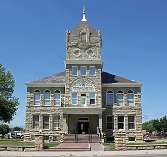
| Zetel | Walsenburg | ||
| FIPS-code | 08055 | ||
| Opgericht | 1861 | ||
| Website | www | ||
| Foto's | |||
| |||
 Bevolkingspiramide Huerfano County | |||
| Statistieken volkstelling Huerfano County | |||
| |||
Huerfano County is een county in de Amerikaanse staat Colorado.
De county heeft een landoppervlakte van 4.120 km² en telt 7.862 inwoners (volkstelling 2000). De hoofdplaats is Walsenburg.
Bevolkingsontwikkeling
| Jaar | Inwoners | % ± | |
|---|---|---|---|
| 1900 | 8.395 | — | |
| 1910 | 13.320 | 58,7% | |
| 1920 | 16.879 | 26,7% | |
| 1930 | 17.062 | 1,1% | |
| 1940 | 16.088 | −5,7% | |
| 1950 | 10.549 | −34,4% | |
| 1960 | 7.867 | −25,4% | |
| 1970 | 6.590 | −16,2% | |
| 1980 | 6.440 | −2,3% | |
| 1990 | 6.009 | −6,7% | |
| 2000 | 7.862 | 30,8% | |
| Bron: (en) Historical Decennial Census Population | |||