Houston County (Georgia)
| County in de Verenigde Staten | |||
|---|---|---|---|
| |||
| Situering | |||
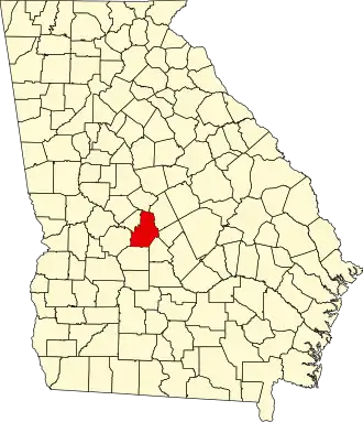
| Staat | Georgia | ||
| Coördinaten | 32°27'36"NB, 83°40'12"WL | ||
| Algemeen | |||
| Oppervlakte | 984 km² | ||
| - land | 976 km² | ||
| - water | 8 km² | ||
| Inwoners (2000) |
110.765 (113 inw./km²) | ||
| Overig | |||
| Zetel | Perry | ||
| FIPS-code | 13153 | ||
| Opgericht | 1821 | ||
| Website | www | ||
| Foto's | |||

| |||
 Bevolkingspiramide Houston County | |||
| Statistieken volkstelling Houston County | |||
| |||
Houston County is een county in de Amerikaanse staat Georgia.
De county heeft een landoppervlakte van 976 km² en telt 110.765 inwoners (volkstelling 2000). De hoofdplaats is Perry.
Bevolkingsontwikkeling
| Jaar | Inwoners | % ± | |
|---|---|---|---|
| 1900 | 22.641 | — | |
| 1910 | 23.609 | 4,3% | |
| 1920 | 21.964 | −7,0% | |
| 1930 | 11.280 | −48,6% | |
| 1940 | 11.303 | 0,2% | |
| 1950 | 20.964 | 85,5% | |
| 1960 | 39.154 | 86,8% | |
| 1970 | 62.924 | 60,7% | |
| 1980 | 77.605 | 23,3% | |
| 1990 | 89.208 | 15,0% | |
| 2000 | 110.765 | 24,2% | |
| Bron: (en) Historical Decennial Census Population | |||