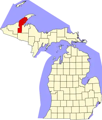
Houghton County
| County in de Verenigde Staten | |||
|---|---|---|---|
| |||
| Situering | |||
| Staat | Michigan | ||
| Coördinaten | 46°58'48"NB, 88°39'0"WL | ||
| Algemeen | |||
| Oppervlakte | 3.889 km² | ||
| - land | 2.620 km² | ||
| - water | 1.269 km² | ||
| Inwoners (2000) |
36.016 (14 inw./km²) | ||
| Overig | |||
| Zetel | Houghton | ||
| FIPS-code | 26061 | ||
| Opgericht | 1845 | ||
| Website | www | ||
| Foto's | |||
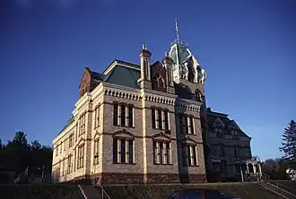
| |||
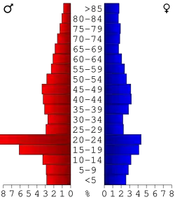 Bevolkingspiramide Houghton County | |||
| Statistieken volkstelling Houghton County | |||
| |||
Houghton County is een county in de Amerikaanse staat Michigan.
De county heeft een landoppervlakte van 2.620 km² en telt 36.016 inwoners (volkstelling 2000). De hoofdplaats is Houghton.
Bevolkingsontwikkeling
| Jaar | Inwoners | % ± | |
|---|---|---|---|
| 1900 | 66.063 | — | |
| 1910 | 88.098 | 33,4% | |
| 1920 | 71.930 | −18,4% | |
| 1930 | 52.851 | −26,5% | |
| 1940 | 47.631 | −9,9% | |
| 1950 | 39.771 | −16,5% | |
| 1960 | 35.654 | −10,4% | |
| 1970 | 34.652 | −2,8% | |
| 1980 | 37.872 | 9,3% | |
| 1990 | 35.446 | −6,4% | |
| 2000 | 36.016 | 1,6% | |
| Bron: (en) Historical Decennial Census Population | |||