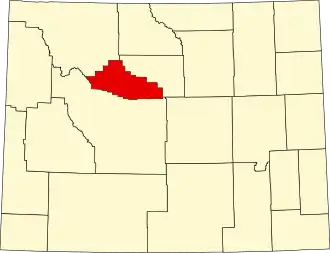
Hot Springs County
| County in de Verenigde Staten | |||
|---|---|---|---|
| |||
| Situering | |||
| Staat | Wyoming | ||
| Tijdzone | Mountain Standard Time (UTC−7) | ||
| Coördinaten | 43°42'36"NB, 108°26'24"WL | ||
| Algemeen | |||
| Oppervlakte | 5.196 km² | ||
| - land | 5.190 km² | ||
| - water | 6 km² | ||
| Inwoners (2000) |
4.882 (1 inw./km²) | ||
| Overig | |||
| Zetel | Thermopolis | ||
| FIPS-code | 56017 | ||
| Opgericht | 1911 | ||
| Website | www | ||
| Foto's | |||

| |||
 Bevolkingspiramide Hot Springs County | |||
| Statistieken volkstelling Hot Springs County | |||
| |||
Hot Springs County is een van de 23 county's in de Amerikaanse staat Wyoming.
De county heeft een landoppervlakte van 5.190 km² en telt 4.882 inwoners (volkstelling 2000). De hoofdplaats is Thermopolis.