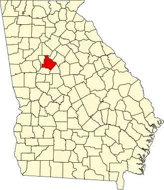
Henry County (Georgia)
| County in de Verenigde Staten | |||
|---|---|---|---|
| |||
| Situering | |||
| Staat | Georgia | ||
| Coördinaten | 33°27'36"NB, 84°9'36"WL | ||
| Algemeen | |||
| Oppervlakte | 841 km² | ||
| - land | 836 km² | ||
| - water | 5 km² | ||
| Inwoners (2000) |
119.341 (143 inw./km²) | ||
| Overig | |||
| Zetel | McDonough | ||
| FIPS-code | 13151 | ||
| Opgericht | 1821 | ||
| Website | www | ||
| Foto's | |||

| |||
 Bevolkingspiramide Henry County | |||
| Statistieken volkstelling Henry County | |||
| |||
Henry County is een county in de Amerikaanse staat Georgia.
De county heeft een landoppervlakte van 836 km² en telt 119.341 inwoners (volkstelling 2000). De hoofdplaats is McDonough.
In de county ligt het Panola Mountain State Park met de berg Panola Mountain.
Bevolkingsontwikkeling
| Jaar | Inwoners | % ± | |
|---|---|---|---|
| 1900 | 18.602 | — | |
| 1910 | 19.927 | 7,1% | |
| 1920 | 20.420 | 2,5% | |
| 1930 | 15.924 | −22,0% | |
| 1940 | 15.119 | −5,1% | |
| 1950 | 15.857 | 4,9% | |
| 1960 | 17.619 | 11,1% | |
| 1970 | 23.724 | 34,7% | |
| 1980 | 36.309 | 53,0% | |
| 1990 | 58.741 | 61,8% | |
| 2000 | 119.341 | 103,2% | |
| Bron: (en) Historical Decennial Census Population | |||