Henderson County (Illinois)
| County in de Verenigde Staten | |||
|---|---|---|---|

| |||
| Situering | |||
| Staat | Illinois | ||
| Coördinaten | 40°48'36"NB, 90°55'48"WL | ||
| Algemeen | |||
| Oppervlakte | 1.023 km² | ||
| - land | 981 km² | ||
| - water | 42 km² | ||
| Inwoners (2000) |
8.213 (8 inw./km²) | ||
| Overig | |||
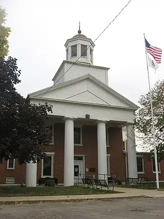
| Zetel | Oquawka | ||
| FIPS-code | 17071 | ||
| Opgericht | 1841 | ||
| Website | www | ||
| Foto's | |||
| |||
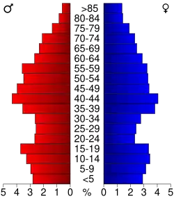 Bevolkingspiramide Henderson County | |||
| Statistieken volkstelling Henderson County | |||
| |||
Henderson County is een county in de Amerikaanse staat Illinois.
De county heeft een landoppervlakte van 981 km² en telt 8.213 inwoners (volkstelling 2000). De hoofdplaats is Oquawka.
Bevolkingsontwikkeling
| Jaar | Inwoners | % ± | |
|---|---|---|---|
| 1900 | 10.836 | — | |
| 1910 | 9.724 | −10,3% | |
| 1920 | 9.770 | 0,5% | |
| 1930 | 8.778 | −10,2% | |
| 1940 | 8.949 | 1,9% | |
| 1950 | 8.416 | −6,0% | |
| 1960 | 8.237 | −2,1% | |
| 1970 | 8.451 | 2,6% | |
| 1980 | 9.114 | 7,8% | |
| 1990 | 8.096 | −11,2% | |
| 2000 | 8.213 | 1,4% | |
| Bron: (en) Historical Decennial Census Population | |||